
Neurum Creek camping, D'Aguilar National Park: access, booking and facilities
Neurum Creek camping in D'Aguilar National Park near Woodford: 4WD access, booking, toilets, rules, swimming and what to bring.
Open No closure listed for the camping area. D'Aguilar's only current alert is the Scrub Road and Red Ash causeway closure (to 13 November 2026), which affects Scrub Road, not Neurum Creek Road. The northern section closes after heavy rain. Checked on the operator's alerts page .
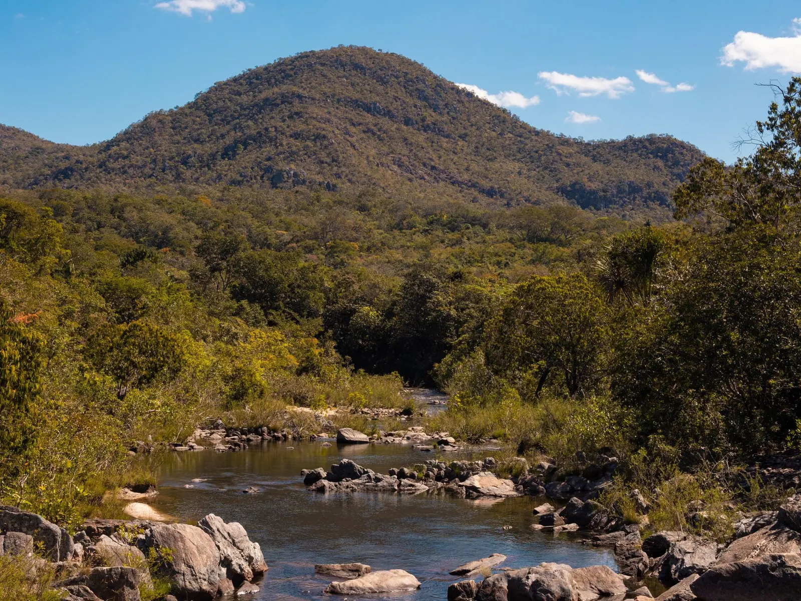
Neurum Creek camping is a small forest campground beside a creek in the northern section of D’Aguilar National Park, roughly 76 kilometres from Brisbane by the figure the parks agency gives. It sits near Woodford and Mount Mee and is reached on forest tracks rather than sealed road. This guide covers how to get in, what the sites offer, the rules to check, and what to pack for a night or a weekend.
Is Neurum Creek a current campground?
Yes. Queensland Parks and Wildlife Service lists the Neurum Creek camping area under D’Aguilar National Park, and the state booking service takes reservations for it. Neurum Creek Bush Retreat is a different, private camping property that borders the park, so do not confuse the two when you search. This guide covers the national park campground.
What is Neurum Creek camping area like?
It is forest camping beside Neurum Creek, in the north of D’Aguilar National Park. Sources describe 13 numbered sites, each with its own parking spot and a fireplace, and a maximum of six people per site. A 2018 visitor account describes defined dirt pads, with bollards separating the vehicle space from the tent area. That makes it car-side tent camping.
D’Aguilar National Park itself covers a long run of ranges north-west of Brisbane. Wikipedia describes eucalypt woodland, pockets of subtropical rainforest and a bird list of more than 240 species, including the noisy pitta and paradise riflebird. Wikipedia notes that the park has two vehicle-accessible camping areas in the Mount Mee section, and Neurum Creek is one of them. The other is Archer.
Can you camp at Neurum Creek with a caravan, camper trailer or campervan?
Access is the deciding factor. The booking service says the road in is only suitable for four-wheel-drive vehicles and 4WD camper trailers, and that the area is not suitable for low-clearance vehicles, caravans or motorhomes. Only sites 2, 4, 5, 8 and 11 are described as suiting small, off-road camper trailers, and the other sites are for tents set up close to your vehicle. Third-party listings go further and rule out trailers altogether, so treat the official booking page as the final word and read it before you commit a trailer to the track.
The parks listing says a 4WD or trail bike is needed for vehicle access, so the last stretch is unsealed forest track whatever you travel on. Check the park alerts for current road conditions before you leave.
4WD or trail bikeAccess
13 numbered sitesSites
Septic or flushToilets
None recordedShowers
How do you get to Neurum Creek camping area?
There are two approaches, and they are very different.
From the south, the route runs about 24 kilometres from Dayboro along Mount Mee Road and Sellin Road to The Gantry. At The Gantry you turn right onto Neurum Creek Road and continue about 6 kilometres, then turn right and travel 400 metres to the camp. A 2018 visitor found the section beyond The Gantry classed as 4WD but in excellent condition, with ordinary cars using it that day. That was one dry-weather observation.
From the north, you drive about 17 kilometres from Woodford along the D’Aguilar Highway, then Neurum, Stanton and Rassmussen roads to the park’s northern entrance. Continue along Lovedays Road for 6 kilometres, passing the Archer camping area on the right, turn left onto L Traverse for 2 kilometres, turn right onto Mount Mee forest drive and travel 3 kilometres. The Archer link has been described as a more challenging 4WD road.
There is no phone service at the camp. The booking page says the nearest reliable reception is at The Gantry, so save directions and your confirmation before you leave town.
Do you need to book Neurum Creek camping area?
Yes. Camping permits are required and fees apply, and the operator says to book before entering the park because there is no phone service at the camping area. Booking is through the Queensland national parks booking service. Check-in is from 2 pm and check-out is by 11 am. A camping tag showing your booking number must be displayed at your site. Read the current fee on the booking page.
Does Neurum Creek camping area have showers and toilets?
There are toilets but no showers. Listings call them septic or flush toilets, and no shower facilities are recorded for this camp.
Water is available at the camp, but it must be treated before drinking, and the parks agency says not to drink from the creek or taps without treating it. Bring your own drinking water. Rubbish bins were not present at the camp at the time of the 2018 account, and the usual national park rule applies: carry your rubbish out.
Is Neurum Creek camping area dog friendly?
No, on every source found. Dogs are not permitted in national parks generally, according to the neighbouring private retreat, and one camping guide quotes the Neurum Creek page as saying pets are not permitted at the camping area to protect native wildlife and other campers. Plan on leaving the dog at home or at a private property that takes pets.
What are the camping rules at Neurum Creek?
The booking page points to a separate park rules page, so read it. What the sources agree on:
- Campfires are allowed in the provided fireplace, with conditions, and not during fire bans or prohibitions. The park can also close sites for high fire danger or regeneration.
- Firewood is not supplied and collecting bush wood is prohibited. Bring your own, and the parks agency suggests untreated milled off-cuts. Firewood can be bought in Woodford or Dayboro.
- A fuel stove is recommended and is often the better choice in dry weather.
- Camp only in designated areas, and stay on defined vehicle tracks and walking trails.
- Generators are reported as not permitted by several third-party listings. The operator’s page did not state this, so check before you pack one.
- Take all rubbish with you.
Can you swim at Neurum Creek?
The parks listing names creek swimming as an activity. Do not expect a lake: a 2018 account described a shallow creek, a family favourite, with one area of dry creek bed on the day. Water levels depend on recent rain, so decide on the day. Never swim in flood-coloured water or when the creek is rising.
What is there to do near Neurum Creek?
The camp has a short walking track to the creek, and the 2018 visitor walked Lophostemon Walk, a 750 metre, easy Class 3 circuit with a short rock crossing of the creek. The ExplorOz place page lists these nearby spots, with approximate distances in a straight line:
| Place | Approximate distance |
|---|---|
| Rocky Hole | 1.1 km |
| Bull Falls Lookout | 2.6 km |
| Mill Rainforest Walk | 2.7 km |
| Archer Campground | 4.9 km |
Wikipedia adds that Falls Lookout and Bulls Lookout are reached via the Falls Lookout Track from Neurum Road. The Richmond birdwing butterfly is mentioned in connection with this part of the park.
When is the best time to camp at Neurum Creek?
The closest climate station the ExplorOz page names is Beerburrum Forest Station, about 29 kilometres away. It is lower and warmer than the camp’s own ridges, so treat it as a guide only. Mean maximums run from about 21.6 degrees Celsius in June and July to about 30.3 in January.
| Season | Months | What to expect |
|---|---|---|
| Summer | Dec to Feb | Warmest. Mean maximum around 30 degrees, mean minimum around 19 to 20. Creek swimming appeals most. |
| Autumn | Mar to May | Maximums ease from about 29 to 24 degrees, nights cool to around 13. |
| Winter | Jun to Aug | Mean maximum about 22 to 23, mean minimum as low as 9.5 at the station. Campfire weather. |
| Spring | Sep to Nov | Maximums climb from 26 to 28.5; nights mild at 12 to 17. |
Sites can close for fire danger, so check alerts in any season.
What is the wildlife and safety situation?
Wikipedia lists platypus, echidna and koala among the 66 mammal species recorded in D’Aguilar National Park, plus lace monitors, 26 frog species and the introduced cane toad. The 2018 visitor saw a lace monitor, a sacred kingfisher and a red-bellied black snake along the creek, which is a good reminder to watch where you step near leaf litter and to wear closed shoes. Store food in your vehicle.
On the practical side:
- There is no phone coverage at the camp, so tell someone your plan and your return time.
- Rain can change tracks and creek crossings quickly. The neighbouring retreat warns that the routes through the national park may close in wet weather.
What should you bring to Neurum Creek?
- Confirmation of booking with the booking number, to display on your site tag.
- All drinking water, plus a way to treat tap water.
- Firewood, bought in Woodford or Dayboro, and a fuel stove.
- A tent that can be pitched beside your vehicle, and ground sheet for dirt pads.
- Offline maps and printed directions, because there is no signal at the camp.
- Closed shoes, insect repellent and a first-aid kit.
- A torch or head torch.
What supplies are near Neurum Creek?
Woodford is about 15 kilometres from the neighbouring Neurum Creek Bush Retreat, which lists a newsagency, laundromat, Woolworths, ANZ branch and a TAB there. Woodford Hardware sells camp supplies and refills gas bottles, per the retreat. Fuel is at D’Aguilar, about 19.5 kilometres from the retreat, or Kilcoy at about 22. Fill the tank and buy supplies before you head into the park.
A one-night plan
Book ahead, then shop in Woodford or Dayboro for firewood, ice and water. Arrive after 2 pm, set up, and walk the short track to the creek or Lophostemon Walk before dark. Cook on a stove, light a fire only if allowed that day, and leave by 11 am with your rubbish.
A weekend plan
Arrive after 2 pm on the first day and set camp. On the second, walk to Rocky Hole, Bull Falls Lookout or the Mill Rainforest Walk, then return to swim if the creek is flowing. Leave by 11 am on the last day.
Who suits Neurum Creek and who should go elsewhere
Neurum Creek suits tent campers and small 4WD camper trailer owners who want a quiet forest base, a creek and a short drive from Brisbane. It suits people who are happy without showers or phone reception.
It does not suit caravans, motorhomes or low-clearance cars, anyone who needs showers, or anyone travelling with a dog. Alternatives: the Archer camping area, about 4.9 kilometres away, where official listings mention flush toilets and a BYO-shower cubicle, though its details conflict between sources. The private Neurum Creek Bush Retreat, which lists swimming holes, a shop and rainwater tanks, but does not allow 4WD driving on the property, is another option. Wikipedia also lists a camping ground in Mount Mee State Forest, which is worth checking.
Planning checklist
- Confirm the camping area is open on the parks alerts page.
- Book and print or save your booking number.
- Check the fire danger rating and any fire bans.
- Decide your route and save offline maps.
- Pack water, a fuel stove, firewood and rubbish bags.
Common mistakes
- Arriving without a booking and relying on phone service to make one.
- Towing a caravan or non-off-road trailer to a 4WD-only track.
- Expecting showers.
- Collecting firewood in the park.
- Assuming the creek will be deep enough to swim.
More from the operator: book.parks.qld.gov.au/neurum-creek-camping-area.
Plan it in the app
Save the camp on your route in MotoRidez and the planner shows road closures along the way, and where your tank runs out once you have entered the range of your vehicle. Save the route for offline use before you lose signal: it saves the corridor around your route, not a whole region.
Details come from the operator’s own records and pages, read on 20 October 2026, and change. We do not show prices or availability. Confirm fees, bookings, closures and fire rules with the operator before you go.
Questions riders ask
Can you camp at Neurum Creek in D'Aguilar National Park?
Yes. Neurum Creek camping area is a Queensland national park campground with 13 numbered sites beside the creek, and a camping permit is required.
Do you need to book Neurum Creek camping area?
Yes. The operator says to book before entering the park because there is no phone service at the camp. Booking is through the Queensland national parks booking service.
How much does Neurum Creek camping cost?
Fees apply and can change, so check the current camping fee on the Queensland national parks booking page.
Does Neurum Creek camping area have showers and toilets?
It has toilets (listed as septic or flush) but no showers are recorded. Water is available but must be treated before drinking.
Is Neurum Creek camping area dog friendly?
No. Dogs are not permitted in national parks generally, and a camping guide reports pets are not permitted at this camp. Confirm with Queensland Parks before you travel.
When is the best time to camp at Neurum Creek?
The nearest climate station, Beerburrum Forest Station, shows mild winters and warm summers. Creek swimming suits summer, but check fire danger and park alerts in any season.
How do you get to Neurum Creek camping area?
From the south, take Mount Mee Road and Sellin Road from Dayboro to The Gantry, then Neurum Creek Road. From the north, go via Woodford, Rassmussen Road and Lovedays Road. A 4WD or trail bike is required.
Free, no subscription
Plan the curvy bits. Record the ride.
Watch your
map fill in.
Curvy routing, turn-by-turn voice navigation, ride recording and your ridden-roads map, with nothing behind a paywall.



Join the waitlist
Bring MotoRidez to your roads
The more riders register from your region, the sooner we get there. Put your name down, then send it to your ride group to move your region up the queue.
You're on the list ✓
Nice — you're in the queue
Every rider you bring moves your region up the list. Share it with your mates and your ride groups.