
Girraween camping: the Bald Rock Creek closure and where to camp now
Girraween camping after the Bald Rock Creek camping area closed: where to camp now, alerts, the cold and what to bring.
Open · no park alerts listed Queensland Parks and Forests listed no current park alerts for Girraween National Park on its camping page when checked. Camping needs a permit booked in advance. Checked on the operator's alerts page .
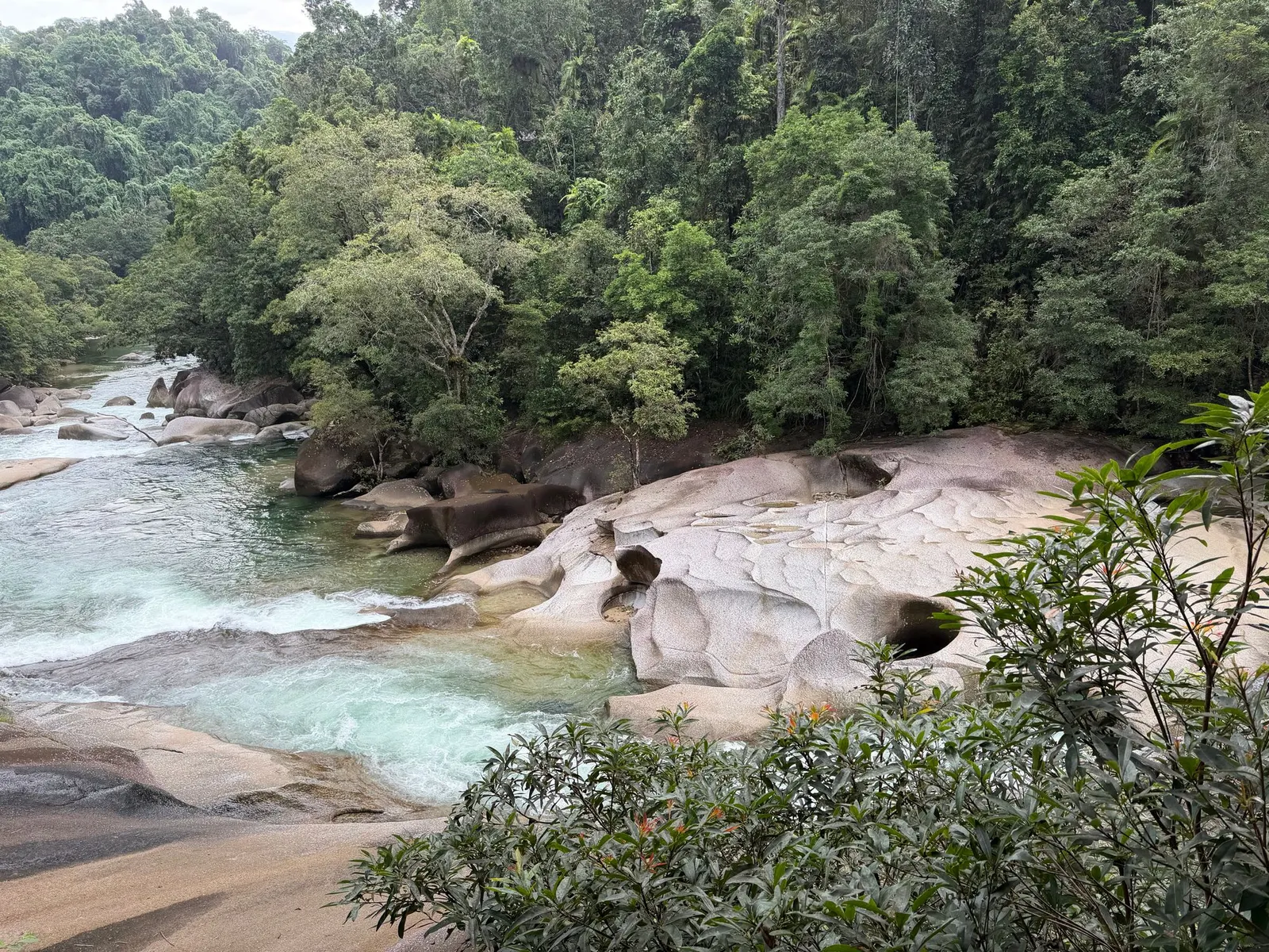
Bald Rock Creek camping at Girraween National Park, on the Granite Belt of southern Queensland, is a search that now leads somewhere slightly different from where it used to. The Bald Rock Creek camping area was closed after about 50 years of use, and Queensland Parks and Wildlife Service (QPWS) now sends campers to other areas inside the same park. The creek, the granite and the setting are unchanged, so this guide explains what happened, where you sleep today, and how to plan a cold, high-country stay in any kind of vehicle or on foot.
Can you still camp at Bald Rock Creek?
Not in the old campground. A Queensland Government media statement from July 2022 said the camping area was closing after 50 years because of concerns about wastewater and soil erosion, and that a $3.3 million upgrade had been completed in June 2022. Bald Rock Creek is now a day-use area. Older directory listings, some last updated years ago, still describe sites, showers and rates there, so treat them as history.
The operator’s current camping page lists Castle Rock, Kambuwal and Terrawambella as the built camping areas, plus a group of remote bush camps. Camping permits are required and fees apply, and you display a tag with your booking number at your site.
What is Girraween National Park like?
Girraween is a granite park on the Queensland and New South Wales border, about 40 km south of Stanthorpe, and it is a twin of Bald Rock National Park across the border. Wikipedia gives its size as 117 square kilometres, with elevation from roughly 800 m up to Mount Norman at 1,267 m. The name is said to come from an Aboriginal word meaning place of flowers.
Weathering has left domes, tors and balancing boulders, and the landmarks have names to match: the Pyramids, Castle Rock, the Sphinx, Turtle Rock and the Eye of the Needle. The park has Underground Creek, seasonal waterfalls and granite rock pools, and Dr Roberts Waterhole is a popular swimming spot.
How do you get to Girraween?
The park sits roughly 260 km south-west of Brisbane by road, according to a camping directory that cites Queensland data. The usual approach leaves the New England Highway about 26 km south of Stanthorpe, or about 30 km north of Tenterfield, and runs about 9 km east on bitumen to the park. The same directory notes an alternative from Stanthorpe through Eukey and Storm King Dam with some gravel sections. Check road conditions before choosing the back way.
Pyramids Road leads to the visitor information building, the Bald Rock Creek day-use area and the camping areas. Confirm vehicle limits for your chosen area when booking, since the old Bald Rock Creek site was unsuitable for buses, caravans and motorhomes.
ClosedOld campground
RequiredCamping permit
Not permittedCampfires
Not permittedGenerators
Which camping area should you choose now?
- Castle Rock was redeveloped with sites for all users, including dedicated sites for large groups and for people with disabilities. The operator lists toilets, showers and barbecues, and says there are no campfires, generators or dogs. Its trailer area takes caravans and camper trailers, and it has a separate tent area.
- Kambuwal is new, with sites among trees and granite, suited to small trailers and tents of various sizes. The same bans on campfires, generators and dogs apply, check-in is after 2 pm and checkout is by 11 am, and parts may be closed from time to time for regeneration.
- Terrawambella is aimed at organised groups, with open grassed areas and room for larger camping structures. It has a group tent area for groups of 25 to 55 people and a trailer area, and generators and dogs are not allowed.
- Remote bush camps include South Bald Rock, Haydens Ridge, Stone Cottage and Dingo Swamp. They have no toilets, showers, campfires, generators or dogs, and sites are not signposted, so they suit people with navigation skills and a leave-no-trace approach.
Sites at the built areas are not numbered. Choose the section that matches your set-up: tent, trailer or group.
Do you need to book Girraween camping?
Yes. Permits are required for every camping area, and bookings go through the Queensland National Parks booking system. Check the booking site for how far ahead you can reserve.
Fees vary by area and group type and change over time, so check the booking page rather than a directory. The operator also posts temporary alerts. When the camping page was read on 3 November 2026 it listed no current park alerts. Alerts for water, swimming or closures can appear at short notice. Both can change, so read the alerts before you pay or pack swimmers.
Does Girraween have showers and toilets?
Castle Rock’s tent area lists toilets and showers, and the new areas are built facilities rather than bush sites. The operator describes the remote camps as having neither.
Drinking water is a recurring theme. The park advises boiling or treating water before drinking it, and the day-use area has toilets, picnic tables, electric barbecues and water. Water supply has been a constraint here: the campgrounds closed temporarily in 2018 during drought, so check the alerts for water limits. Carry extra drinking water in any vehicle and do not rely on a tap for everything.
Is Girraween dog friendly?
No. Dogs are not permitted at Castle Rock, Kambuwal, Terrawambella or the remote bush camps, and the old Bald Rock Creek area also banned pets. If your dog travels with you, plan kennelling or camp outside the park and visit it on your own.
What are the rules on fires, generators and rubbish?
- Campfires are not permitted at Castle Rock or Kambuwal, and the remote camps ban them as well. Barbecue facilities are provided at Castle Rock instead. Bring a gas or fuel stove.
- Generators are not allowed at any of the camping areas listed above.
- Rubbish: the old Bald Rock Creek site provided no bins, so plan to carry yours out to a bin in town.
- Stay on defined tracks and trails, and camp only in designated areas to protect fragile vegetation.
- Check Bureau of Meteorology forecasts, bushfire warnings and fire bans before you leave.
When is the best time to camp at Girraween?
Girraween is high country, and temperatures reflect it. The park’s own safety page says winters are dry and cold, with frosty nights averaging a minimum of 1 degree Celsius and winter nights able to drop to minus 8. Summer days are around 25 to 30 degrees with cooler nights near 15, and most rain falls from November to March. Southern Downs Regional Council notes snow can fall in the area during winter.
The table uses the Stanthorpe weather station at 784 m, so Girraween’s higher ground may run cooler.
| Season | Months | Mean max (Stanthorpe) | Mean min (Stanthorpe) |
|---|---|---|---|
| Summer | Dec to Feb | about 27 degrees | about 15 to 16 degrees |
| Autumn | Mar to May | 19 to 25 degrees | 6 to 14 degrees |
| Winter | Jun to Aug | 16 to 18 degrees | 2 to 3 degrees |
| Spring | Sep to Nov | 21 to 26 degrees | 6 to 13 degrees |
Stanthorpe holds Queensland’s lowest recorded temperature, minus 10.6 degrees on 23 June 1961, and recorded up to 8 cm of snow on 17 July 2015. Wikipedia suggests autumn and spring as the best seasons, and the park’s wildflower displays peak in spring.
What is there to do near the camping areas?
Girraween has more than 17 km of graded tracks, according to Wikipedia:
- Dr Roberts Waterhole, 600 m return, easy.
- Sphinx Rock, 1.5 km return, easy.
- The Pyramids, 2.8 km return, moderate. The state says about 80 per cent of visitors climb it.
- Junction Rock, 3.2 km return, moderate.
- Castle Rock, 6.4 km return, challenging, with natural lookouts over eucalypt woodland.
- Mount Norman, 11.4 km return, challenging.
- Underground Creek Circuit, 9 km.
The Wyberba walk has a constructed lookout over The Pyramid and is described as wheelchair accessible with assistance.
What wildlife will you see?
Wikipedia lists about 40 mammal species, including wombats, wallabies, spotted quolls and sugar gliders, and more than 120 bird species including superb lyrebirds and turquoise parrots. The park’s discovery guide mentions brush-tailed rock-wallabies near Nundubbermere Falls. The rare Bald Rock Creek turtle lives in roughly a 10 km stretch of this creek, which is a good reason to respect any swimming restriction.
Mammals are easiest to see at dawn and dusk. The park recommends a torch with a red filter for night viewing, which disturbs animals less.
What should you bring?
- A sleeping bag and layers rated for below-zero nights, plus a warm hat. Bring a heavier tent or swag cover than you would for the coast.
- Extra drinking water and a way to treat water.
- A gas or fuel stove, since campfires are banned in the main areas.
- Rubbish bags, because bins are not guaranteed at your site.
- Your camping tag and booking confirmation, and walking boots with grip for granite.
- Fuel and food bought in town before you drive in.
What supplies and services are nearby?
Stanthorpe, the main town of the Granite Belt, had 5,286 residents at the 2021 census and is a fruit and wine district. A fuel price site lists stations there, including on Wallangarra Road, High Street and the New England Highway. Wallangarra, closer to the park, may have no fuel, so fill up before turning off. Check groceries and opening hours locally.
The park visitor information building is next to the camping area road, and QPWS can be reached on 13 74 68. The building’s planned works (19 to 23 October 2026) have finished.
A one-night plan
Arrive after check-in, which is 2 pm at Kambuwal, and set up while the sun is up, because temperatures drop quickly at this elevation. Walk Sphinx Rock or Dr Roberts Waterhole before dark and cook on a stove. In the morning, climb The Pyramids early, then leave before the 11 am checkout.
A weekend plan
Day one: arrive, set up and do the short walks. Day two: Castle Rock, 6.4 km return, with a picnic at the day-use area afterwards. Day three: a gentler walk, then pack up. If you have a third day and strong legs, Mount Norman is 11.4 km return and challenging.
Who is Girraween camping for, and who should go elsewhere?
It suits tent campers, small camper trailers and swag users, and walkers who want granite scenery and cold, clear nights. It is a poor match for dog owners, generator users and anyone wanting a campfire. Large caravans and motorhomes should check section limits before booking. If you want a campfire or need to bring a dog, look for private accommodation in the Stanthorpe area instead.
Planning checklist and common mistakes
- Confirm your chosen area and section on the booking page.
- Read the current park alerts for water and swimming limits.
- Check forecasts, fire bans and road conditions.
- Pack for frost, whatever the season.
- Arrange pet care in advance.
Common mistakes include searching by an old directory name, expecting a campfire, not carrying spare water and underestimating winter lows.
More from the operator: parks.des.qld.gov.au/parks/girraween/things-to-do.
Plan it in the app
Save the camp on your route in MotoRidez and the planner shows road closures along the way, and where your tank runs out once you have entered the range of your vehicle. Save the route for offline use before you lose signal: it saves the corridor around your route, not a whole region.
Details come from the operator’s own records and pages, read on 20 October 2026, and change. We do not show prices or availability. Confirm fees, bookings, closures and fire rules with the operator before you go.
Questions riders ask
Can you camp at Bald Rock Creek in Girraween?
Not in the old campground, which closed after about 50 years because of wastewater and erosion concerns. Camping is now at Castle Rock, Kambuwal, Terrawambella or the remote bush camps.
Do you need to book camping at Girraween National Park?
Yes, camping permits are required and booked through the Queensland National Parks booking system. Display the tag showing your booking number at your site.
How much does camping at Girraween cost?
Fees apply and vary by camping area and group type. Check the Queensland National Parks booking page for current rates.
Does Girraween have showers and toilets?
Castle Rock's tent area lists toilets, showers and barbecues. The remote bush camps have no toilets or showers.
Is Girraween National Park dog friendly?
No. Dogs are not permitted at Castle Rock, Kambuwal, Terrawambella or the remote bush camps.
When is the best time to camp at Girraween?
Autumn and spring are generally the milder seasons. Winters are dry and cold with frosty nights, and summers are warm with most rain from November to March.
How do you get to Girraween National Park?
The park is about 40 km south of Stanthorpe. Turn off the New England Highway and follow about 9 km of bitumen road east to the park, then Pyramids Road to the camping areas.
Free, no subscription
Plan the curvy bits. Record the ride.
Watch your
map fill in.
Curvy routing, turn-by-turn voice navigation, ride recording and your ridden-roads map, with nothing behind a paywall.



Join the waitlist
Bring MotoRidez to your roads
The more riders register from your region, the sooner we get there. Put your name down, then send it to your ride group to move your region up the queue.
You're on the list ✓
Nice — you're in the queue
Every rider you bring moves your region up the list. Share it with your mates and your ride groups.