
Charlie Moreland camping, Kenilworth: facilities, booking and what to expect
Charlie Moreland camping near Kenilworth in Imbil State Forest: road in, toilets, fires, dogs, booking, walks and the best season.
Open · Mt Allan tower closed Queensland Parks lists the Mt Allan fire tower as closed to climbing from 29 April 2024 to 31 May 2027, and a wet weather access notice for Conondale National Park from 20 October to 10 November 2026. No closure of the camping area itself is listed. Heavy rain can flood creek crossings. Checked on the operator's alerts page .
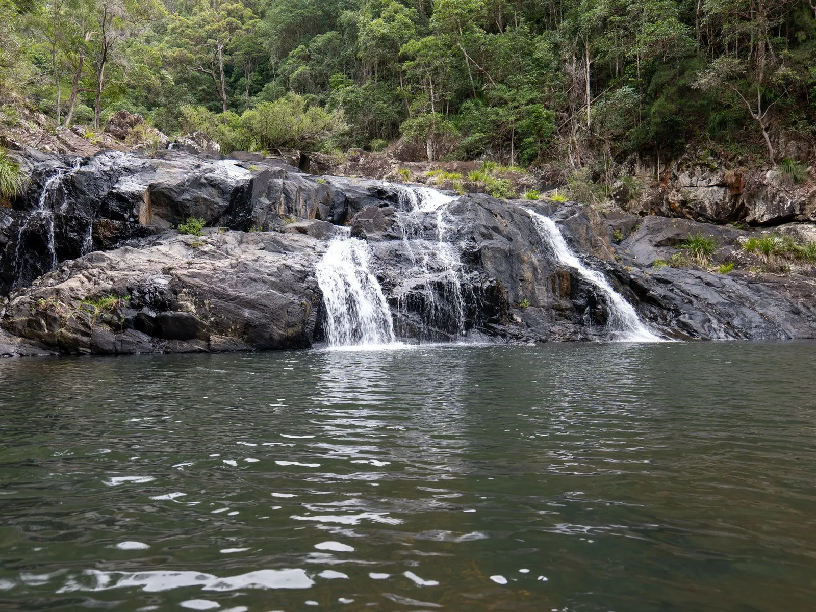
Charlie Moreland camping area is a large, open, grassy campground beside Little Yabba Creek in the Sunshine Coast hinterland, a short drive from Kenilworth. Queensland Parks lists it under Imbil State Forest, so searches for “Kenilworth State Forest camping” usually lead to this same place. It takes tents, camper trailers, campervans, caravans and small motorhomes. This guide covers the road, the camp, the rules, the walks, the seasons and the nearest town so you can decide whether it suits your trip.
What is Charlie Moreland camping area?
It is a Queensland Parks and Wildlife Service campground in Imbil State Forest, set among open forest and native pine plantations near Little Yabba Creek. The operator describes an informal layout with no separately defined sites, so campers pick their own patch of grass. The camp reopened in 2015 after a major upgrade, and a Queensland Government release at the time gave its capacity as 380 people.
The camp sits roughly two hours by road from Brisbane, according to one review, while Kenilworth itself is 149 km north of the Brisbane CBD. Kenilworth is a small Mary Valley town of 604 people at the 2021 census, and most of the surrounding land is dairy country, state forest or national park.
How do you get to Charlie Moreland camping area?
From Kenilworth, take the Kenilworth to Maleny road and turn onto Sunday Creek Road, about 7 km from the township. The remaining drive on Sunday Creek Road is unsealed. Reviewers describe it as roughly 5 km of gravel, and it includes a concrete causeway over a creek. Queensland Parks says the camping area is reached along Sunday Creek Road by high-clearance four-wheel-drive vehicles and off-road camper trailers in dry weather. Two-wheel-drive vehicles can only reach it from the east on the unsealed road, which includes a concrete causeway over a creek, and the operator advises caution in wet weather. Treat a conventional car as workable in dry conditions, and check the operator’s current road notes before you tow anything.
Other approaches exist. Beyond the camp, Sunday Creek Road becomes a four-wheel-drive track that one reviewer calls a through route to Jimna. A listing on the CampWatch site warns that heavy rain can flood creek crossings and that the grass softens after rain, so pick firmer ground and check alerts before leaving. Mobile coverage is not available at the camp, so download your permit and directions before you leave Kenilworth, and arrive in daylight.
The sources mention no shop at the camp, so arrive with everything you need, whatever you travel in.
Do you need to book Charlie Moreland camping area?
Yes. Camping permits are required and fees apply, and you book through the Queensland National Parks booking service (online, or by phone on 13 74 68). A booking phone is reported at the ranger station on the drive in. Display the camping tag with your booking number at your site. Fee amounts change, so read the current figure on the booking page instead of relying on a blog.
The camp is popular. One review urges booking as early as possible, and a CampWatch listing says school holidays and long weekends are often crowded and less private, while weekdays are usually calmer. CampWatch also lists check-in after 2 pm and check-out before 11 am, but confirm times on your permit.
RequiredCamping permit
Flush toiletsToilets
None reportedShowers
Not allowedDogs
What is the camp like?
The camp is a wide grassy flat with fire rings, a day-use area with picnic tables and barbecues, and flush toilets, some of them wheelchair accessible. Open grass suits caravans and camper trailers. The forest edges give more shade and quiet but uneven ground, according to CampWatch. A Day Use Area was described by one 2019 visitor as shadier than the camping sites.
Facilities to plan around:
- Toilets: flush toilets are listed by the operator.
- Showers: reviewers report none, so bring a solar shower or wash in the creek responsibly.
- Water: taps are provided, but the water is not drinkable without treatment. Treat it or bring your own.
- Fires: fire rings are provided, and fires are allowed when no fire ban applies. Bring your own firewood and do not collect timber in the forest.
- Rubbish: no bins are provided, so take everything out and keep food away from wildlife.
- Generators: reviewers say they are not permitted.
- Horses: there is an enclosed paddock for campers who bring horses.
- Phone: no mobile coverage; a pay phone is reported at the ranger’s office.
Is Charlie Moreland camping area dog friendly?
No. Dogs and other pets are not allowed in the camping area, and one review extends the restriction across Imbil State Forest. Horses are the exception: they are allowed on shared trails and roads, and campers can keep them in the paddock. If a dog is part of your trip, look at private caravan parks in the Mary Valley or ask the operator about pet-friendly sites.
What can you do near the camp?
The camp is a base for short forest walks and a creek.
- Fig Tree walk: a 780 m circuit from the end of Sunday Creek Road, suitable for wheelchairs. Wear enclosed shoes because stinging tree leaves grow beside the track.
- Little Yabba circuit: 1.5 km return, with a wade through Little Yabba Creek. A reviewer rates it suitable for young children.
- Piccabeen circuit: 3.5 km return, passing a grove of piccabeen palms.
- Mount Allan shared trail: 8.8 km return and steep. Horse riders, mountain bikers, rangers and logging vehicles use it. A 300 m walking track leads to the summit and a fire tower, but the Mt Allan fire tower is closed to climbing from 29 April 2024 to 31 May 2027. A recent notice reported the tower closed to climbing until 31 May 2027, so check before you climb.
The operator also links the camp with the Conondale Range Great Walk via the Mount Allan shared trail. Little Yabba Creek is the swimming spot, with a sandy beach area and room for inflatable boats and kayaks. A December 2019 visitor found most of the creek dried up in drought and the water green, so conditions vary year to year. Supervise children, since depth and flow change. Fishing is reported as not permitted.
Children can ride bikes, scooters and skateboards around the camp, according to Brisbane Kids.
When is the best time to camp at Charlie Moreland?
Kenilworth has warm, humid summers and mild winters with cool nights. The table below uses long-term averages for Kenilworth (the source does not state the station or years), so treat the figures as a guide rather than a forecast.
| Season | Months | Mean max range | Mean min range |
|---|---|---|---|
| Summer | Dec to Feb | 29.1 to 29.4 C | 19.5 to 20.6 C |
| Autumn | Mar to May | 23.8 to 28.1 C | 13.8 to 19.8 C |
| Winter | Jun to Aug | 21.6 to 23.3 C | 10.7 to 11.6 C |
| Spring | Sep to Nov | 25.4 to 28.4 C | 13.4 to 17.9 C |
Winter suits walking and campfires, though a reviewer says nights can get cold, so pack warm bedding. Summer is hot and wet, which affects creek crossings and the grass underfoot. Spring and autumn sit between the two. School holidays and long weekends are the crowded periods in any season.
Is Charlie Moreland the right camp for you?
It suits families, groups, caravanners and trailer campers who want an open forest camp with flush toilets and a creek, and who are happy without showers or phone signal. The informal layout favours groups that want space and children who want to roam.
Choose somewhere else if you need a dog-friendly camp, hot showers, powered sites or a private, secluded spot at peak times.
Verified alternatives nearby include the Booloumba Creek camping areas in Conondale National Park, which the operator says need a high-clearance four-wheel drive because of creek crossings. They offer toilets, campfires and no showers. Walkers can also use the Conondale Range Great Walk camps at Wongai, Tallowwood and Summer Falls, each listed with six sites, a one-night limit, untreated water and a toilet. Open fires are not permitted there and bookings are required.
What wildlife and safety points matter?
Reviewers report goannas, red-necked pademelons and many bird species, including bellbirds. A birdwatcher recorded about 50 species over two days, among them paradise riflebird, regent bowerbird, wonga pigeon and azure kingfisher. Keep food secured and rubbish contained, since the camp has no bins.
Safety comes down to a few points. Wear enclosed shoes on the Fig Tree walk, supervise children at the creek, tell someone your plan because there is no mobile coverage, and check for fire bans before lighting a fire. After heavy rain, check road and creek-crossing alerts before you set out.
What supplies and services are nearby?
Kenilworth is the nearest town, about 7 km north of the camp. Wikipedia lists a library, a community school, churches, a museum with a theatrette, and the Kenilworth Cheese Factory, now Kenilworth Dairies. It does not list shops or fuel, so confirm opening hours and stock before relying on them.
Larger centres are further on. Kenilworth is 32.8 km west of Nambour, 40.1 km north-west of Maleny and 20.2 km south of Imbil. Buy food, fuel, gas, ice and firewood before the gravel section, and bring drinking water as well as treatment tablets or a filter.
What should you bring?
- Your permit and directions, saved offline
- Drinking water, plus a way to treat the tap water
- Clean-cut firewood or a fuel stove for fire-ban days
- Rubbish bags to carry waste out
- Warm bedding for cool nights
- Enclosed shoes for the Fig Tree walk
- A solar shower or other washing arrangement
- Chocks or boards for soft ground after rain
One-night plan and weekend plan
For one night, arrive in daylight, choose a site on firm ground, and walk the 780 m Fig Tree circuit before dusk. Cook on the fire ring if no ban applies, and use a fuel stove if one does. Leave by the 11 am check-out time listed by third parties, and allow time for the gravel road.
For a weekend, add the Little Yabba circuit or the Piccabeen circuit on the first morning, swim or paddle the creek in the afternoon, and walk the Mount Allan shared trail on the second day. Start early because the trail is steep and shared with bikes and vehicles.
Common mistakes
- Arriving without a permit on a busy weekend
- Bringing a dog
- Assuming showers or phone signal exist
- Relying on creek water without treating it
- Taking a low trailer onto the road after heavy rain
- Collecting firewood from the forest
- Forgetting that fire bans override the fire rings
Planning checklist
- Book the camp and save the permit offline.
- Check fire bans, road alerts and track closures.
- Shop in Nambour, Maleny or Kenilworth before the gravel.
- Pack water treatment, warm bedding and a stove.
- Tell someone your plan, then leave in time to arrive in daylight.
More from the operator: parks.des.qld.gov.au/parks/conondale/camping (403; search summary).
Plan it in the app
Save the camp on your route in MotoRidez and the planner shows road closures along the way, and where your tank runs out once you have entered the range of your vehicle. Save the route for offline use before you lose signal: it saves the corridor around your route, not a whole region.
Details come from the operator’s own records and pages, read on 20 October 2026, and change. We do not show prices or availability. Confirm fees, bookings, closures and fire rules with the operator before you go.
Questions riders ask
Can you camp at Charlie Moreland?
Yes. It is a Queensland Parks campground in Imbil State Forest near Kenilworth, open to tents, camper trailers, campervans, caravans and small motorhomes. A camping permit is required.
Do you need to book Charlie Moreland camping area?
Yes, camping permits are required and are booked through the Queensland National Parks booking service. The camp is popular, so book early for school holidays and long weekends.
How much does Charlie Moreland camping cost?
Fees apply and vary by person and by season, so check the current rate on the Queensland parks booking page. Older blog figures are out of date.
Does Charlie Moreland have showers and toilets?
The operator lists flush toilets, some wheelchair accessible. Reviewers report there are no showers, and the tap water is not drinkable without treatment.
Is Charlie Moreland dog friendly?
No. Dogs and other pets are not allowed in the camping area. Horses are permitted on shared trails, and an enclosed paddock is available for campers with horses.
When is the best time to camp at Charlie Moreland?
Winter and the shoulder seasons are mild, though winter nights can be cold. Summer is hot and wet, and school holidays and long weekends are the busiest periods.
How do you get to Charlie Moreland camping area?
Take Sunday Creek Road off the Kenilworth to Maleny road, about 7 km from Kenilworth. The unsealed road includes a concrete causeway; check current conditions after rain.
Free, no subscription
Plan the curvy bits. Record the ride.
Watch your
map fill in.
Curvy routing, turn-by-turn voice navigation, ride recording and your ridden-roads map, with nothing behind a paywall.



Join the waitlist
Bring MotoRidez to your roads
The more riders register from your region, the sooner we get there. Put your name down, then send it to your ride group to move your region up the queue.
You're on the list ✓
Nice — you're in the queue
Every rider you bring moves your region up the list. Share it with your mates and your ride groups.