
Frenchmans Creek camping, Upper Big River State Forest: a camper's guide
Frenchmans Creek camping in Upper Big River State Forest, Victoria: how to get there, facilities, fuel distance and what to bring. Not the Barmah camp.
No live status · check conditions Victoria's More to Explore page (updated 14 October 2026) lists no closure for the camp. Forests can close in emergencies, so check VicEmergency and road conditions before you travel. Checked on the operator's alerts page .
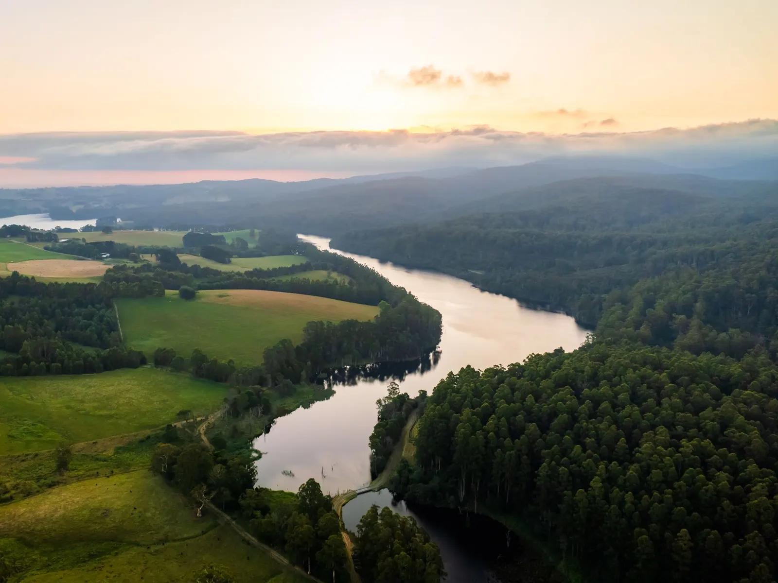
Frenchmans Creek camping means a large, free-to-use bush camp on the banks of Big River, deep inside Upper Big River State Forest in Victoria’s High Country. It is laid out as separate formal areas along the river and the creek, and it is roughly three hours from Melbourne by road. Note the name overlap: a different “Frenchmans” camping area exists in Barmah National Park, a long way away on the Murray. Everything here concerns the Upper Big River State Forest camp reached from Marysville or Warburton.
Where is Frenchmans Creek camping, and what is the setting?
Big River rises on the northern slopes of the Yarra Ranges where Springs Creek and Oaks Creek meet, at about 608 m. It runs generally north for about 62 km through state forest and national park, collects thirteen tributaries including the Torbreck and Taponga rivers, drops about 349 m in total and ends in Lake Eildon at about 260 m. A Lake Eildon tourism page describes the surrounding forest as roughly 6,630 hectares of tall mountain ash and alpine ash, with a remote feel and a logging heritage. Campers describe the Frenchmans Creek sites as grassy and shaded by mountain ash and manna gum, which gives cover from summer sun.
The camp is state forest, and that shapes the experience. Expect a bush camp with minimal infrastructure, not a holiday park with a camp kitchen and a shop.
How do you get to Frenchmans Creek?
From Marysville, take the Woods Point road for 18 km, veer left at Cumberland Junction, then turn left onto Eildon-Warburton Road. Big River Road is about 6 km along on the right. From Warburton, follow the Warburton-Woods Point Road, turn right at Cumberland Junction, then left onto Eildon-Warburton Road. The camp is about 13.5 km along Big River Road from that junction.
Big River Road is an all-weather gravel road with many riverside camps along it, and it suits any vehicle that is comfortable on corrugated gravel. Victoria’s official More to Explore page lists the camp as suitable for 2WD vehicles, with no booking required and no fees payable, and says dogs are allowed. It also notes that Big River Road is all-weather gravel, and that the stretch between 25 Mile Creek and Enochs Point is four-wheel-drive only. Drive to the conditions, particularly after rain, and check road status before leaving.
The section between 25 Mile Creek and Enochs Point is four-wheel-drive only. Frenchmans Creek is reached before it, so you do not need to cross it to get here. Many other forest tracks are narrow and unsealed, and a directory warns that many become 4WD-only in wet weather.
What is the camp like?
The operator describes Frenchmans Creek as spacious, with separate formal camping areas along Big River and Frenchmans Creek so groups can spread out. It takes tents, swags, campervans, and caravans or trailers with room to move. Directories single out Frenchmans Creek, Stockmans Reward and Big River Camp as the forest’s large camps, suitable for small caravans and group gatherings, while the smaller camps suit individuals and small parties.
Recorded facilities are pit toilets and wood-fire BBQ pits. Water, showers and bins are not recorded. Pets are allowed provided they are under control. Camping is first come, first served: the official page says no booking is required and no fees are payable. Confirm with Forest Fire Management Victoria before you go, since details can change. Directories suggest arriving early in peak periods.
Pit toiletsToilets
Wood-fireBBQ pits
AllowedTents and caravans
Separate sitesGroup space
Who should camp here, and who should choose somewhere else?
Frenchmans Creek suits families with a camper trailer, groups wanting room for several vehicles, anglers, and solo campers after a quiet riverside tent site. The spread-out layout means a group can stay together without crowding a single clearing.
Choose somewhere else if you need powered sites, hot showers or a shop on site. If you want a smaller, quieter pitch, Vennells, Reids or Bobuck Ridge are listed along the same forest roads. If you would rather stay near a town with services, Jamieson has a caravan park, and Warburton and Eildon have paid parks listed by directories. Check each directly, because directory data can be dated.
When is the best time to camp at Frenchmans Creek?
The operator’s note is that the drier months are best, and that gravel roads can be slow after rain. The only temperature figures found are Meteostat averages quoted on a camping directory, so the table covers only the seasons they describe.
| Season | Typical daytime high | Typical overnight low | What it means |
|---|---|---|---|
| December to February | about 24 to 27 C | about 12 to 14 C | Warm days under the trees; fire danger is highest, so watch for Total Fire Ban days |
| June to August | about 9 to 11 C | about 4 to 5 C | Properly cold nights; bring warm layers and a rated sleeping bag |
| Spring and autumn | not sourced | not sourced | Check forecasts before travelling |
Marysville records about 725 mm of rain a year, and Jamieson about 1,173 mm, so a wet spell can turn up in any season. No seasonal closure is recorded for this camp, but forests can close in emergencies, so check before you travel.
A one-night plan
Leave Melbourne early enough to reach Marysville with daylight to spare, given the drive is about three hours before you add the gravel. Fill the tank and stock up in Marysville, then follow the directions above and set up with time to gather fallen wood if fires are permitted that day. Spend the evening by the river, cook on the BBQ pit or your stove, and pack everything out in the morning, including food scraps.
A weekend plan
For two nights, treat the first day as setting up and exploring on foot, and the second as the day trip. Fish the river in the morning, which reviewers describe as accessible from the camp, then drive the forest roads for a look at the other camps along Big River Road. Stay on the roads your vehicle suits, and turn back if the surface deteriorates. On the way home, Marysville offers Steavenson Falls and walking tracks, or head north to Jamieson for its gold-rush history.
What is there to do nearby?
Fishing is the main draw. Reviewers mention fishing access at Big River, and tourism listings promote excellent trout fishing in the upper reaches of the rivers that feed Lake Eildon. Check the Victorian Fisheries Authority for licence requirements, seasons and bag limits before you cast a line, because none of those details were confirmed for this stretch.
Other activities listed for the forest include bushwalking, canoeing, gold fossicking, deer hunting, vehicle touring, bird watching and photography. If hunters are active, expect other people in the forest and check the current rules. Directories also list swimming as a popular feature, though specific swimming spots near this camp are not confirmed, so ask locally and check depth and currents before getting in.
Marysville is about 99 km from Melbourne and is the usual gateway from the south. It is known for Steavenson Falls, fern gullies and walking tracks, and it is the access point for Yarra Ranges National Park and Lake Mountain. The town was largely destroyed in the February 2009 bushfires, and its recovery is part of the story of this area. Jamieson, on the northern side of the ranges, was first settled in 1860 and had about 300 people working its goldfields by 1861. Most mining had stopped by the First World War, and the 1939 Black Friday fires destroyed many mine workings. It now has two hotels and a caravan park.
What are the fire and camping rules?
Rules for Victorian state forest camping apply. Camp only in existing sites, at least 20 m from any stream, lake or reservoir. Do not dig trenches around tents. Light fires only in a fireplace or a trench no more than a square metre in size and 30 cm deep, with 3 m cleared around it. Collect only fallen wood and never leave a fire unattended. On Total Fire Ban days, no fires of any kind are allowed, including gas and liquid fuel stoves, so check emergency.vic.gov.au and plan a cold meal for hot, windy days.
Do not put chemicals or general waste in pit toilets. There is no rubbish collection, so everything you bring in goes out with you. Water is not recorded, so carry all you need for drinking, cooking and washing, and treat any river water you use.
What should you bring?
- All drinking and cooking water, plus a way to treat river water as a backup.
- A shovel, a stove, offline maps, and a rubbish bag big enough for the whole stay.
- Wet-weather gear and a tarp, since High Country rain can arrive quickly.
- A rated sleeping bag for cold nights.
- A fishing licence if you intend to fish, and a spare tyre, jack and pressure gauge for the gravel.
- Fuel for the return trip, because the nearest pump is about 59 km away by road.
Planning checklist
Before you leave: check Total Fire Ban status and road conditions, confirm the camp details with Forest Fire Management Victoria, fill the tank, and tell someone your plan.
On arrival: choose an existing site at least 20 m from the water, check overhead branches, and sort your water and rubbish arrangements before dark.
Before you pack up: put the fire out completely, collect all rubbish including small scraps, and leave the site as you found it.
Common mistakes to avoid
- Assuming there is tap water. None is recorded, so arrive with enough.
- Leaving fuel until the last moment. The nearest pump is about 59 km by road.
- Driving on past the camp. The stretch between 25 Mile Creek and Enochs Point is 4WD-only.
- Camping beside the water. Sites must be at least 20 m from streams.
- Lighting a stove on a Total Fire Ban day. Gas and liquid fuel stoves are banned too.
- Relying on a directory alone. Some of the data is dated, so check with the operator.
Where can you buy supplies?
The operator data puts the nearest fuel about 59 km away by road. A camping directory lists a Caltex at Marysville, so fill up there before heading into the forest, and confirm opening hours yourself.
What other camps are nearby?
If Frenchmans Creek is full, or you want something smaller, Big River Road has alternatives. Stockmans Reward and Big River Camp are the other two large camps. Smaller camps listed by directories include Vennells, Reids, Bobuck Ridge, Gang Gang Gully, Married Mens Bush Camp and McClelland Bush Camp. Taponga, along the lower Big River, is listed by the state tourism site as suitable for 2WD with no booking or fees.
More from the operator: exploreoutdoors.vic.gov.au/activities/camping/frenchmans-creek-campground.
Plan it in the app
Save the camp on your route in MotoRidez and the planner shows road closures along the way, and where your tank runs out once you have entered the range of your vehicle. Save the route for offline use before you lose signal: it saves the corridor around your route, not a whole region.
Details come from the operator’s own records and pages, read on 20 October 2026, and change. We do not show prices or availability. Confirm fees, bookings, closures and fire rules with the operator before you go.
Questions riders ask
Can you camp at Frenchmans Creek in Upper Big River State Forest?
Yes. The operator lists it as a large camp with separate formal areas along Big River and Frenchmans Creek for tents, swags, campervans and caravans or trailers. It is a different place from the Frenchmans camping area in Barmah National Park.
Is Frenchmans Creek camping free?
The operator lists state forest camps like this as free, with no bookings recorded, and the state tourism listing says no fees apply. Confirm with Forest Fire Management Victoria before you travel.
How far is Frenchmans Creek camping from Melbourne?
It is roughly three hours by road from Melbourne, via Marysville, Cumberland Junction, Eildon-Warburton Road and about 13.5 km of Big River Road.
Do you need a 4WD to reach Frenchmans Creek?
Big River Road is an all-weather gravel road and the camp is reached before the 4WD-only section between 25 Mile Creek and Enochs Point. Sources disagree about 2WD suitability, so check conditions, especially after rain.
What facilities does Frenchmans Creek have?
The operator records pit toilets and wood-fire BBQ pits. Water, showers and bins are not recorded, so bring water and take your rubbish home.
Can you have a campfire at Frenchmans Creek?
Campfires are allowed in a fireplace or a trench of no more than a square metre, 30 cm deep, with 3 m cleared around it. On Total Fire Ban days no fires or stoves of any kind are allowed.
Are dogs allowed at Frenchmans Creek?
Directory listings say pets are allowed in Victorian state forests provided they are under control at all times. Check with the operator for any current restrictions.
Free, no subscription
Plan the curvy bits. Record the ride.
Watch your
map fill in.
Curvy routing, turn-by-turn voice navigation, ride recording and your ridden-roads map, with nothing behind a paywall.



Join the waitlist
Bring MotoRidez to your roads
The more riders register from your region, the sooner we get there. Put your name down, then send it to your ride group to move your region up the queue.
You're on the list ✓
Nice — you're in the queue
Every rider you bring moves your region up the list. Share it with your mates and your ride groups.