
Cosy Corner South camping, Bay of Fires: a free camp guide
Cosy Corner South camping in the Bay of Fires: a free Tasmanian camp, toilets, fire rules, busy periods and what to bring.
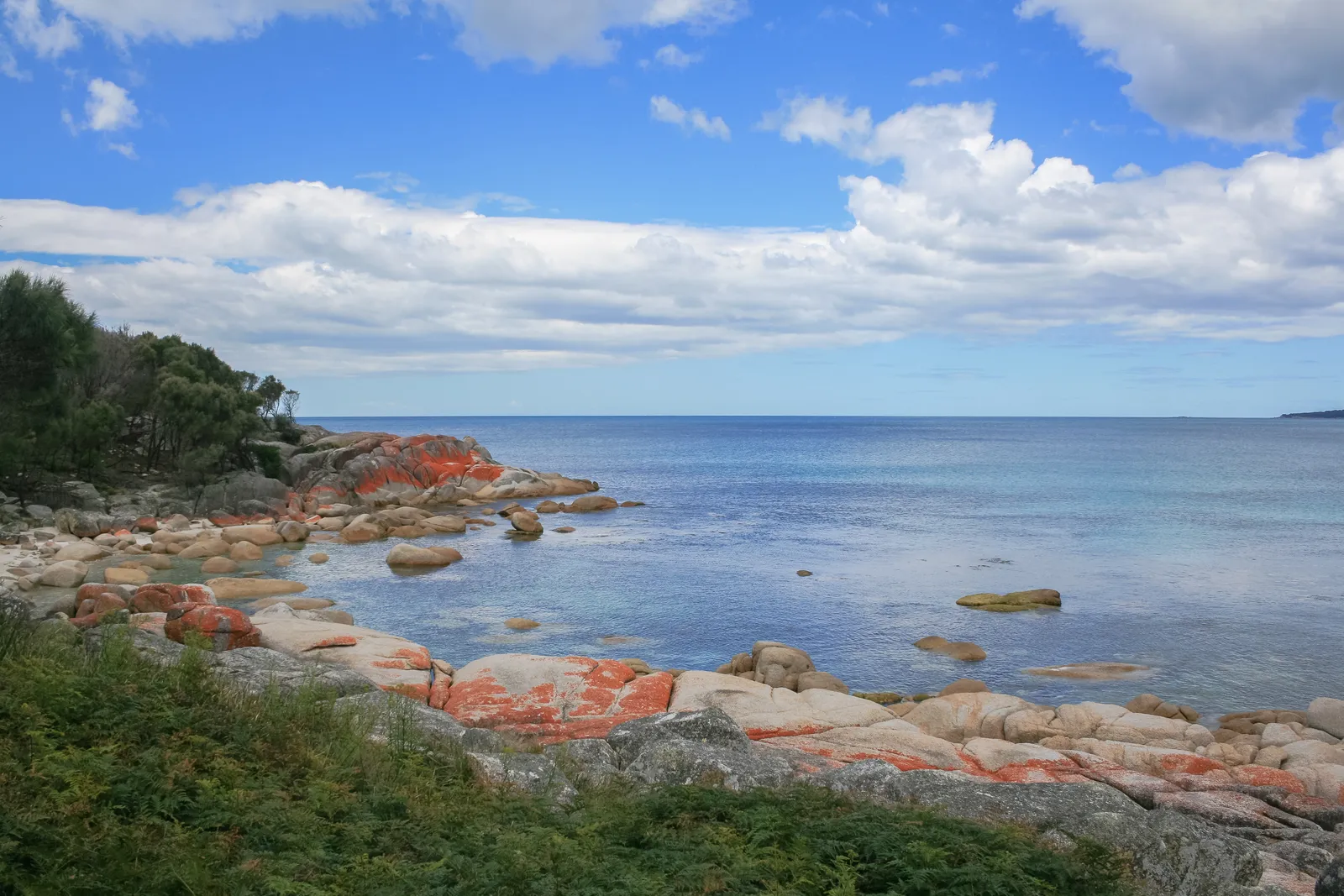
Searching for Cosy Corner camping usually leads to one of the best-known free camping spots in Tasmania. Cosy Corner South sits on the north-east coast, in the southern end of the Bay of Fires Conservation Area. Parks and Wildlife Service Tasmania lists it as free with no bookings, taking tents, caravans and campervans. Bay of Fires camping is simple rather than comfortable, and this guide sets out what the operator and other sources say so you can decide whether it fits your trip.
What is the Bay of Fires Conservation Area?
The Bay of Fires is a string of bays running from Binalong Bay in the south to larapuna/Eddystone Point in the north, known for white sand, clear water and granite boulders coloured orange by lichen. The orange comes from the lichen, not the rock itself. The southern end is a conservation area, while the northern section lies inside Mount William National Park.
The coast matters to Tasmanian Aboriginal people. It was a meeting place for Aboriginal family groups, and the dunes hold shell middens protected under the Aboriginal Heritage Act 1975, so keep off the dunes and leave anything you find. Captain Tobias Furneaux named the bay in 1773 after seeing fires on the beaches, and shore-based whaling took place here in the 1840s. Binalong Bay, the gateway village, began as a fishing hamlet and has a small harbour known locally as the gulch and a cafe. It is about 12 kilometres north-east of St Helens.
Cosy Corner is split into a South and a North camp, each by its own beach. Discover Tasmania describes the beaches as linked by white sand and sheltered by rocky points, and says some elevated sites at the South camp have coastal vegetation cover and shoreline views.
How do you get to Cosy Corner South?
From St Helens, take Binalong Bay Road (C850), then turn left onto C848 at the sign for The Gardens, 13 kilometres away. The sealed road runs past the camps, which are roughly 7 kilometres along it, and ends at private land at The Gardens. The sealed approach suits any vehicle, including caravans and campervans. The operator advises against driving in reserves at night because of wildlife on the roads, so plan to arrive in daylight. The operator puts St Helens about 30 minutes away.
What is the camp like?
The operator lists hybrid and pit toilets. Other listing sites describe only pit toilets, so confirm the toilet type on the Parks and Wildlife Service page. Older listings report no tap water, no firewood and no rubbish collection, and the official Bay of Fires page does not mention drinking water at all. Plan on being self-sufficient.
Camping is permitted only in designated campgrounds, not on beaches or dunes. The maximum stay is four weeks. The listing describes total site numbers and capacity as estimates only, so treat any figure you see as indicative. Discover Tasmania says the camp does not cater for people with access needs.
Is Cosy Corner free, and do you need a parks pass?
The operator lists the campground as free, with no bookings required. On passes, the official Bay of Fires page says the northern section, from the Ansons River mouth to larapuna/Eddystone Point, is within Mount William National Park and requires a parks pass. It states no pass requirement for the southern section, which includes Cosy Corner. Rules change, so check the Parks and Wildlife Service site before you travel, especially if you plan to continue north.
Who does this camp suit, and who should choose somewhere else?
It suits self-contained campers who are happy with basic facilities: tent campers, caravanners, campervan travellers, cyclists and motorcyclists who can carry their own water. It also suits anyone who wants to wake up beside a beach and be a short drive from a town.
Choose somewhere else if you need powered sites, showers, a camp kitchen or step-free access. Choose elsewhere too if you want a guaranteed pitch in peak periods, because the operator describes the camp as very popular in school holidays, at Christmas and Easter, and on long weekends, and there is no booking system to secure a spot.
The operator lists these alternatives. In the southern section: Grants Lagoon, Jeanneret Beach, Swimcart Beach, Cosy Corner North, Seatons Cove and Sloop Reef. In the northern section: Policemans Point, near the Ansons Bay river mouth, reached from St Helens via Ansons Bay Road (C843) or east from Gladstone on North Ansons Road (C83). Dogs are the main difference between them, since they are allowed on leads at all of these except Jeanneret Beach. Further north, Mount William National Park has six designated campsites, with five main camping areas near its northern entrance and Deep Creek Campground near Eddystone Point. The northern entrance is 17 kilometres of unsealed road from Gladstone, and a parks pass is required there.
What is there to do nearby?
- Beaches. Cosy Corner Beach has a sheltered stretch. Jeanneret Beach is a 250 metre white-sand beach bordered by granite and lichen-covered rocks, and Swimcart Beach suits long walks and sunrises, with surf fishing common.
- Swimming. The protected bays are good for it, but the operator warns of steep drop-offs and rips. Swimcart Beach is described as rough with strong currents.
- Fishing, kayaking and diving. Rock fishing, kayaking, snorkelling and scuba diving are listed activities.
- Walking. The operator mentions long coastal walks and links to a full list on its website. Check track conditions there before heading out.
- The Gardens. The scenic drive ends here, where the sealed road stops.
- Eddystone Point. At the northern end, Mount William National Park holds a pink granite lighthouse that opened in 1889, plus walks such as the 90-minute return climb of wukalina/Mount William, 216 metres, and the two-hour Cobler Rocks walk.
- Wildlife. Humpback and southern right whales are often seen close to shore, with dolphins and seals common. Shorebirds include hooded plovers and oystercatchers. Wallabies and possums are common, while quolls and Tasmanian devils are rarer. Swift parrots visit in warmer months to feed on blue gum flowers. Do not feed wildlife.
Suggested plans
One night. Arrive in daylight with water and food bought in St Helens. Set up, then walk the beach at Cosy Corner. Spend the evening on a fuel stove or, if no restrictions apply, a fire pot. In the morning, walk Swimcart or Jeanneret Beach before packing out.
A weekend. Add a day trip along the C848 to The Gardens, a swim only if conditions are calm, and an afternoon at Binalong Bay for the cafe and harbour. Keep a spare day of water in case the weather turns. A weekend on a long weekend means arriving early.
When is the best time to visit?
These are mean temperatures for St Helens Aerodrome (2001 to 2024), taken from Wikipedia. They describe the town, not the campsite, which may differ on an exposed coast.
| Season | Months | Mean max | Mean min |
|---|---|---|---|
| Summer | Dec to Feb | 21.3 to 22.9 C | 11.8 to 13.5 C |
| Autumn | Mar to May | 16.1 to 21.1 C | 7.2 to 11.9 C |
| Winter | Jun to Aug | 13.6 to 14.3 C | 4.9 to 5.6 C |
| Spring | Sep to Nov | 16.1 to 19.5 C | 6.7 to 10.2 C |
Annual rainfall averages about 718 millimetres, with November the wettest month at 77.9 millimetres and July the driest at 44 millimetres. Summer is also peak season, so the shoulder months can be quieter, though nights cool quickly. The official page lists no seasonal closures, but it was last modified in 2022, so check its Alerts page for current closures.
What are the rules for fire, safety and rubbish?
- Fire. Campfires are permitted when restrictions are not in force, and the operator encourages campers to bring a fire pot. Restrictions often apply in summer, so check local signs and the Tasmania Fire Service website. A fuel stove is recommended because restrictions can change. Put fires fully out and make sure no hot coals remain.
- Swimming. Rips and steep drop-offs make swimming and surf fishing risky. Keep children close and avoid going out alone.
- Dogs. Dogs on leads are allowed in all the southern campgrounds except Jeanneret Beach. Break O’Day Council manages dog zones and publishes a map.
- Waste. Take rubbish with you. Do not empty chemical toilets into the campground toilets. The nearest blackwater dump point is in St Helens, on the corner of Tully and Young streets.
What are the common mistakes?
- Arriving without enough water because the camp has no listed tap supply.
- Assuming a fire is allowed without checking signs and fire bans.
- Leaving rubbish because no collection is listed.
- Turning up on a school holiday or long weekend late in the day.
- Driving the coast road at night when wildlife is active.
- Walking over dunes where shell middens are protected.
What should you bring?
Because no tap water or rubbish collection is listed, carry more drinking water than you expect to need, plus washing water and rubbish bags. Bring a fuel stove, a fire pot if you want a fire when permitted, warm layers, strong pegs and wind-resistant shelter for a coastal site, swimming gear, a torch for the walk to the toilets, a fishing rod for the rocks and binoculars for whales.
Pack for a spread of conditions rather than the average. The table shows that even summer mornings sit around 12 to 13 degrees at St Helens and winter nights fall to roughly 5, so a warm sleeping bag earns its space in any season. Because the operator lists no water or firewood, and fires may be banned, plan every meal around a stove and every drink around what you carry in.
Planning checklist
- Check the Parks and Wildlife Service page for pass rules, alerts and toilet details.
- Check the Tasmania Fire Service website for fire bans.
- Stock up on food and fuel before you arrive.
- Fill every water container.
- Plan a daylight arrival and an alternative camp.
Where can you get supplies?
The operator advises stocking up on food and fuel before arriving. St Helens is the nearest town, and Wikipedia mentions shops on Cecilia Street, including the Bay of Fires IGA. Binalong Bay has a cafe. Check opening hours before relying on any of them for a late arrival.
More from the operator: parks.tas.gov.au/explore-our-parks/bay-of-fires-conservation-area/bay-of-fires-camping.
Plan it in the app
Save the camp on your route in MotoRidez and the planner shows road closures along the way, and where your tank runs out once you have entered the range of your vehicle. Save the route for offline use before you lose signal: it saves the corridor around your route, not a whole region.
Details come from the operator’s own records and pages, read on 20 October 2026, and change. We do not show prices or availability. Confirm fees, bookings, closures and fire rules with the operator before you go.
Questions riders ask
Is Cosy Corner camping free?
The Parks and Wildlife Service lists the Bay of Fires campgrounds as free, with no bookings required. The maximum stay is four weeks.
Do you need a parks pass for Cosy Corner?
The official page says the northern section, inside Mount William National Park, requires a pass, but states no requirement for the southern section. Check the Parks and Wildlife Service site before you go.
Can you have a campfire at Cosy Corner South?
Campfires are permitted when fire restrictions are not in force, and campers are encouraged to bring a fire pot. Check local signs and the Tasmania Fire Service website, as restrictions often apply in summer.
What toilets does Cosy Corner South have?
The operator lists hybrid and pit toilets, while some other listings mention only pit toilets. Confirm on the Parks and Wildlife Service page.
Are dogs allowed at Cosy Corner?
Dogs on leads are allowed in the Bay of Fires campgrounds except Jeanneret Beach. Break O'Day Council manages dog zones and provides a map.
Is there drinking water at Cosy Corner South?
The official page does not mention drinking water and older listings say there is none. Bring all the water you need.
Can caravans and campervans camp at Cosy Corner South?
Yes, the listing says tents, caravans and campervans suit, and the road in is sealed. Facilities are basic, so be self-sufficient.
Free, no subscription
Plan the curvy bits. Record the ride.
Watch your
map fill in.
Curvy routing, turn-by-turn voice navigation, ride recording and your ridden-roads map, with nothing behind a paywall.
Join the waitlist
Bring MotoRidez to your roads
The more riders register from your region, the sooner we get there. Put your name down, then send it to your ride group to move your region up the queue.
You're on the list ✓
Nice — you're in the queue
Every rider you bring moves your region up the list. Share it with your mates and your ride groups.