
Station Creek camping, NSW: 29 bush sites, a 4WD-only track and a surf beach 600 m away
Station Creek camping in Yuraygir National Park: 29 unpowered sites, high-clearance 4WD access, a surf beach 600 m away, booking and rules.
Open · road warnings and a feral animal notice NPWS shows no closure. It lists two safety warnings for dangerous road conditions (from 8 October 2026, under review) and a feral animal control notice to 31 December 2026. Checked on the operator's alerts page .
Map: Station Creek and what is around it
Pan and zoom. Solid lines are sealed roads, dashed brown lines are gravel and unsealed roads, and purple lines are named twisty roads. Tap a pin or a road for details, and use the buttons to switch layers on and off.
The interactive map needs WebGL, which this browser does not offer. The places around the camp are listed below.
Lookouts, waterfalls and peaks
- Blackbutt Point Lookout · 1.0 km
- Viewing Platform Lookout · 3.9 km
- Viewing Platform Lookout · 4.1 km
- Woolgoolga Headland Lookout · 18.0 km
- Bluff Trail Lookout Lookout · 26.8 km
- Lower Bucca Lookout Lookout · 32.1 km
- Woopi Waterfall Waterfall · 21.9 km
- Jam Falls Waterfall · 23.2 km
- Scout Falls Waterfall · 23.9 km
- Infinity Pool Waterfall · 25.7 km
- Green Hills Peak, 27 m · 3.1 km
- Cabbage Tree Mountain Peak, 208 m · 6.2 km
- Browns Knob Peak, 325 m · 12.3 km
- Glenugie Peak Peak, 316 m · 22.0 km
Fuel
- Caltex 11.2 km in a straight line
- Coles Express Halfway Creek 14.8 km in a straight line
- United Mullaway 15.0 km in a straight line
Food and coffee
- Ji-leigu-Jura-I Café 8.8 km
- Koko's Café 9.6 km
- Spinifex Restaurant 12.0 km
- Beachouse Cafe 18.2 km
- Bluebottles 18.2 km
Other camps nearby
- Pebbly Beach Camp Ground 1.2 km
- Reflections Red Rock - Holiday Park 3.9 km
- Wooli Camping and Caravan Park 9.1 km
- Corindi Beach Reserve Campground 9.2 km
- Reflections Corindi Beach - Holiday Park 9.6 km
Distances are in a straight line from the camp, not by road. Places and roads come from OpenStreetMap and can be out of date: confirm fuel and opening hours before you rely on them. An unsealed road on the map is not necessarily open to vehicles, and in national parks many are fire trails, so check the park alerts and signs. Map data © OpenStreetMap contributors.
Station Creek camping sits on the estuary of Station Creek in the southern part of Yuraygir National Park, on the North Coast of New South Wales between Coffs Harbour and Yamba. It is a remote, unpowered bush campground with 29 marked sites, a short walk to a surf beach, and a road in that needs a high-clearance four-wheel drive. This guide covers how to get there, what the campground has and does not have, the rules, the seasons and what to pack, using the information published by NSW National Parks and Wildlife Service (NPWS).
What is Station Creek Campground?
Station Creek Campground is one of nine campgrounds listed for Yuraygir National Park, alongside Boorkoom, Illaroo, the Illaroo group camping area, Lake Arragan and Red Cliff, Pebbly Beach, Rocky Point, Sandon River and Shelley Head. NPWS describes the park as having the longest stretch of undeveloped coastline in the state, with cliffs, headlands, beaches, lakes, forest, heath and wetland over roughly 65 km of coast.
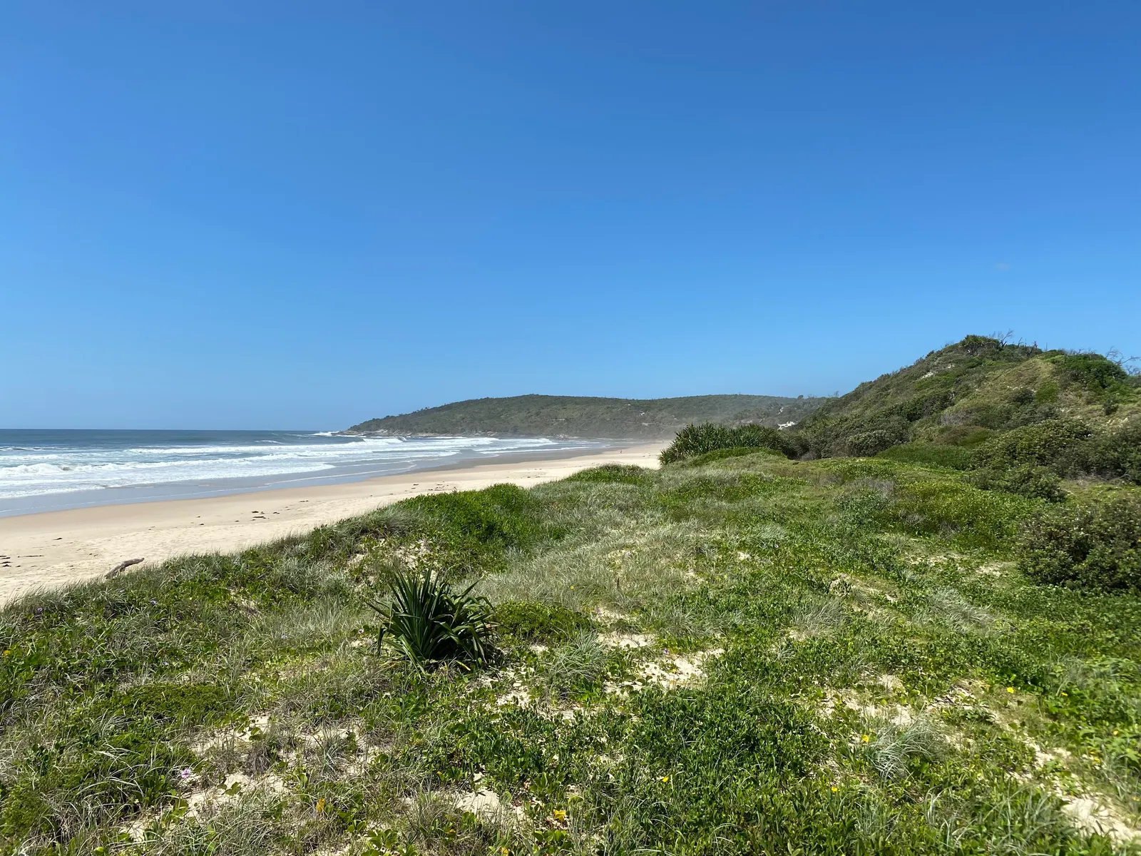
Within that, Station Creek is the creekside option. The camp is on the estuary, and the ocean beach is about 600 metres away along a track lined with scribbly gum and corkwood trees. Wikipedia records that the park covers about 314 square kilometres and was established in 1980 by merging the earlier Angourie and Red Rock national parks, both created in 1975.
Can you camp at Station Creek?
Yes. NPWS shows no closure, but its local alerts on 29 Oct 2026 list two safety warnings for dangerous road conditions (both from 8 Oct 2026 and under review) and a feral animal control notice running to 31 Dec 2026. NPWS also says the whole park may close in poor weather or fire danger. Read the alerts immediately before you leave.
Camping options on the NPWS page:
- Tent camping.
- Camping beside your vehicle.
- High-clearance camper trailer sites.
- High-clearance caravan sites for caravans up to 4.6 metres.
All 29 sites are unpowered and marked. Parking is arranged in nodes, so vehicle-based and tent-based campers are grouped rather than every site having its own driveway.
Do you need to book Station Creek?
NPWS runs online booking for this campground, and you can also book through the National Parks Contact Centre on 1300 072 757 (7am to 7pm daily). Check-in is 2pm and check-out is 10am. Online group bookings cover up to 40 people or nine sites; larger groups submit a group booking enquiry.
An older regional listing describes first come, first served entry, which conflicts with the current NPWS page, so treat NPWS as the authority. Park entry fees apply and can be paid at the time of booking, and an annual pass is available. Fees change, so confirm them on the NPWS campground page.
How do you get to Station Creek?
The turn-off is from the Pacific Highway onto McPhillips Road, about 39 km south of Grafton or 47 km north of Coffs Harbour. Follow McPhillips Road for about 5.8 km, turn left onto Barcoongere Way, then follow the campground signs. The campground is in the southern precinct of the park.
The road is the main planning issue. NPWS says all the roads in are unsealed and that access is only for high-clearance 4WD vehicles and high-clearance trailers or caravans. The roads can become boggy after rain, and four-wheel drive is required in wet weather. Water crossings can change quickly after rain.
Access also depends on roads managed by Clarence Valley Council and Forestry Corporation, so closures are published in more than one place. Check the Forestry Corporation website and Live Traffic before you leave. One older regional listing warned that Barcoongere Way was not recommended for any vehicle because of severe damage; that may no longer apply, but it is a reason to confirm current conditions rather than assume.
Anyone arriving without a high-clearance vehicle should ask the Grafton office first.
29, unpoweredSites
High-clearance 4WDAccess
Not providedDrinking water
Non-flushToilets
What facilities does Station Creek have?
The NPWS listing and visitor information give this set:
- Non-flush toilets, including accessible toilets with a concrete path and a timber ramp with handrails.
- Wood barbecues and picnic tables, with the tables being accessible.
- Rubbish bins.
- Firewood for sale at the campground, or you can bring your own.
What is not provided: there is no drinking water at the campground, so bring drinking and cooking water. Showers are not listed by NPWS, so plan on none. Power is not available because sites are unpowered, and mobile reception is limited.
Does Station Creek have showers?
Showers are not listed among the campground facilities, and NPWS tells campers to bring their own water. Plan on a washing routine that does not need a tap, such as a water container or a solar shower.
Is Station Creek dog friendly?
No. NPWS states that pets and domestic animals are not permitted at the campground, with the exception of certified assistance animals. If you travel with a dog, choose a different place to stay.
What are the rules at Station Creek?
Rules the operator publishes for this campground:
- Generators are listed as a prohibited activity.
- Noise restrictions apply.
- Smoking is not allowed, as in all NSW national parks.
- The NSW Rural Fire Service Commissioner can declare a total fire ban for particular areas or the whole state in fire weather. Check bans before you light a campfire or barbecue.
- Bins are provided.
NPWS does not state a maximum stay or a minimum stay on the campground page. If you want a long stay, confirm with the Grafton office.
When is the best time to camp at Station Creek?
NPWS does not name a single best time. It does describe what each season offers on this stretch of coast, and gives climate figures for the area.
| Season | What NPWS notes |
|---|---|
| Summer | Swimming, surfing and snorkelling; average 20 to 26 degrees Celsius, highest recorded 42.5 |
| Autumn | Beach fishing; March is the wettest month |
| Winter | Whale watching as whales migrate north; average 9 to 20 degrees Celsius, lowest recorded 2.7 |
| Spring | Heathland wildflowers and coastal walks; September is the driest month |
Whale watching on the NPWS park page is given as May to September. The highest one-day rainfall recorded in the area was 300 mm, so road conditions after heavy rain matter as much as the season.
What is there to do near Station Creek?
The NPWS page lists 26 activities near the campground, most of them walking, birdwatching and wildlife, sightseeing and swimming, with fishing, surfing, canoeing and waterfalls also appearing. The campground itself is described as suited to swimming, fishing, canoeing and relaxing in the shade, and as family friendly.
Things you can build a stay around:
- The beach. The 600 metre track from camp leads to the ocean. The beach is not patrolled.
- The creek. Fishing, canoeing and swimming on the estuary.
- Corkwood and Scribbly Gum walk. This is one of the ten walking tracks NPWS lists for the park, and the name matches the trees lining the beach track.
- Yuraygir Coastal Walk. A four-day, roughly 65 km walk along the coast, with guided options.
- Whale watching. NPWS names Red Cliffs Lookout and Brooms Head as viewing points during the northward migration.
- Wildlife. NPWS mentions brolgas around the water’s edge, with emus visiting occasionally.
Is Station Creek safe? Wildlife, weather and phone reception
The campground is remote, so arrive prepared. Mobile reception is limited and you need reception to call Triple Zero (000); NPWS suggests downloading the Emergency Plus app before the trip.
The beaches in the park are not patrolled and can have strong rip currents. NPWS advises swimming only between the red and yellow flags at a patrolled beach, and the Beachsafe site helps you find one. That means a swim at the camp beach is a decision to make carefully, not a default.
Fire danger is the other hazard. Summer’s highest recorded temperature in the area is 42.5 degrees Celsius, and the park may close due to fire danger. Wikipedia lists feral pigs, cats, dogs, horses and foxes as pests in the park, so store food securely.
What should you bring to Station Creek?
NPWS says to bring drinking water, cooking water and firewood (firewood is also sold on site). Beyond that, the lack of water, power and showers sets the list:
- Enough water for every person for the whole stay, plus a spare day.
- Recovery gear for boggy sections.
- A cooler that runs without mains power.
- Cooking fuel in case a fire ban applies.
- A satellite messenger or offline maps, given the limited reception.
- Rubbish bags and a plan for taking out what you bring.
- Sun protection and warm layers for winter nights.
Where are the nearest supplies and services?
The NPWS page names Grafton and Coffs Harbour as reference points for the turn-off, 39 km north and 47 km south respectively. They are the sensible places to buy groceries, fuel and anything you forgot before the unsealed drive. Minnie Water has shops that sell firewood, according to the Illaroo campground page,, so do not rely on small villages for a full resupply. The Grafton office is open Monday to Friday, 8.30am to 4.30pm, on 02 6641 1500.
A one-night plan
Buy fuel, water and food in Grafton or Coffs Harbour, check Live Traffic, and arrive after the 2pm check-in. Set up, then walk the 600 metre beach track while it is light. Cook on the wood barbecue if no fire ban applies, and spend the evening by the creek. Pack up before the 10am check-out.
A weekend plan
Day one is the same as the one-night plan. On day two, spend the morning on the creek for fishing or canoeing, then walk the beach and stay on the sand away from rips. In winter, drive out to Red Cliffs Lookout or Brooms Head for whale watching; in spring, add a heathland walk such as Wilsons Headland. Leave before the 10am check-out so you cover the unsealed roads in daylight.
Who is Station Creek for, and who should go elsewhere?
Station Creek suits campers with a high-clearance 4WD, a camper trailer built for rough tracks or a small caravan under 4.6 metres, who are comfortable with no water, no power and no showers.
Choose somewhere else if you are travelling with a dog, need power, need a hot shower, or have a conventional caravan or a two-wheel-drive car.
Alternatives within Yuraygir, all with different compromises:
- Illaroo Campground. 70 unpowered marked sites for tents, camper trailers, caravans and camping beside the vehicle, with drinking water, toilets, barbecues, picnic tables and bins. Showers are not mentioned. Check the visitor information page for access.
- Sandon River Campground. 29 unpowered sites on a gravel road whose condition varies and may not suit some caravans. It has toilets, barbecues, picnic tables, a boat ramp and a public phone, but no water.
The two NPWS pages do not say whether pets are allowed at either, so ask before bringing a dog.
Planning checklist
- Book through NPWS and note the 2pm check-in and 10am check-out.
- Check campground and park alerts, Live Traffic and Forestry Corporation closures.
- Confirm your vehicle, trailer or caravan is high clearance.
- Confirm fire-ban status the day you leave.
- Load fuel, water and food before the unsealed roads.
- Download offline maps and the Emergency Plus app.
Common mistakes
- Assuming a sedan can manage the roads.
- Trusting an old listing that describes different entry arrangements.
- Forgetting water, or planning on a generator.
- Underestimating rain: roads become boggy and crossings change quickly.
- Swimming at an unpatrolled beach without checking for rips.
More from the operator: nationalparks.nsw.gov.au/camping-and-accommodation/campgrounds/station-creek-campground.
Plan it in the app
Save the camp on your route in MotoRidez and the planner shows road closures along the way, and where your tank runs out once you have entered the range of your vehicle. Save the route for offline use before you lose signal: it saves the corridor around your route, not a whole region.
Details come from the operator’s own records and pages, read on 20 October 2026, and change. We do not show prices or availability. Confirm fees, bookings, closures and fire rules with the operator before you go.
Questions riders ask
Can you camp at Station Creek in Yuraygir National Park?
Yes. NSW National Parks lists Station Creek Campground as open with 29 marked, unpowered sites for tents, vehicle-side camping, and high-clearance camper trailers and caravans up to 4.6 metres. Check alerts before you travel, as the park can close for weather or fire danger.
Do you need to book Station Creek campground?
NPWS takes online bookings and phone bookings on 1300 072 757, with check-in at 2pm and check-out at 10am. Older listings mention first come, first served, so use the NPWS page as the current source.
How much does Station Creek camping cost?
Fees vary and change, and park entry fees apply on top of camping fees. Check the NPWS campground page when you book for the current amounts.
Does Station Creek campground have showers and toilets?
It has non-flush toilets, including accessible ones, but showers are not listed. There is no drinking water, so bring your own.
Is Station Creek campground dog friendly?
No. NPWS states pets and domestic animals are not permitted, except certified assistance animals.
When is the best time to camp at Station Creek?
NPWS does not name one best time. Summer suits swimming and surfing, winter brings whale watching (May to September), spring has heathland wildflowers, and heavy rain at any time can make the road boggy.
How do you get to Station Creek campground?
Turn off the Pacific Highway onto McPhillips Road, about 39 km south of Grafton or 47 km north of Coffs Harbour. Continue about 5.8 km, turn left onto Barcoongere Way and follow the signs; the roads are unsealed and need a high-clearance 4WD.
Free, no subscription
Plan the curvy bits. Record the ride.
Watch your
map fill in.
Curvy routing, turn-by-turn voice navigation, ride recording and your ridden-roads map, with nothing behind a paywall.



Join the waitlist
Bring MotoRidez to your roads
The more riders register from your region, the sooner we get there. Put your name down, then send it to your ride group to move your region up the queue.
You're on the list ✓
Nice — you're in the queue
Every rider you bring moves your region up the list. Share it with your mates and your ride groups.