
Ingar Campground camping, Blue Mountains: booking, access and rules
Ingar Campground camping on Kings Tableland, Blue Mountains: walk-in access, booking, fees, water, rules and what to bring.
Open · fire ban to 31 Mar 2027 NPWS shows no closure. A fire ban applies from 8 October 2026 to 31 March 2027, and a permanent safety warning says the tracks in can be overgrown. Checked on the operator's alerts page .
Map: Ingar and what is around it
Pan and zoom. Solid lines are sealed roads, dashed brown lines are gravel and unsealed roads, and purple lines are named twisty roads. Tap a pin or a road for details, and use the buttons to switch layers on and off.
The interactive map needs WebGL, which this browser does not offer. The places around the camp are listed below.
Lookouts, waterfalls and peaks
- Bedford Creek Lookout Lookout · 0.4 km
- Linda Rock Lookout · 2.7 km
- Adams Lookout Lookout · 3.6 km
- Edith Falls Lookout Lookout · 5.7 km
- Sydney Rock Lookout · 6.1 km
- Minnatonka Falls Lookout · 6.6 km
- Wallace Falls Waterfall · 2.0 km
- Parrott Falls Waterfall · 2.2 km
- Daken Falls Waterfall · 2.5 km
- Pyramid Falls Waterfall · 3.1 km
- Mount Bedford Peak · 0.7 km
- South Hill Peak · 0.7 km
- North Hill Peak · 1.9 km
- West Hill Peak · 2.2 km
Fuel
- Ampol 5.6 km in a straight line
- Shell 6.4 km in a straight line
- Metro Petroleum 9.3 km in a straight line
Food and coffee
- 20 Mile Hollow 4.3 km
- World Burger 4.3 km
- The Parade Cafe 5.3 km
- Hazelbrook Kebab, Pide & Pizza 5.5 km
- Thai Square 5.6 km
Other camps nearby
- Murphys Glen Campsite 2.1 km
- Bulls Camp Reserve 5.6 km
- Kedumba River Crossing campground 9.7 km
- Perch Ponds 10.7 km
- Buttenshaw Park Faulconbridge 11.6 km
- Camp fire site 11.8 km
- Kedumba Park 12.1 km
Distances are in a straight line from the camp, not by road. Places and roads come from OpenStreetMap and can be out of date: confirm fuel and opening hours before you rely on them. An unsealed road on the map is not necessarily open to vehicles, and in national parks many are fire trails, so check the park alerts and signs. Map data © OpenStreetMap contributors.
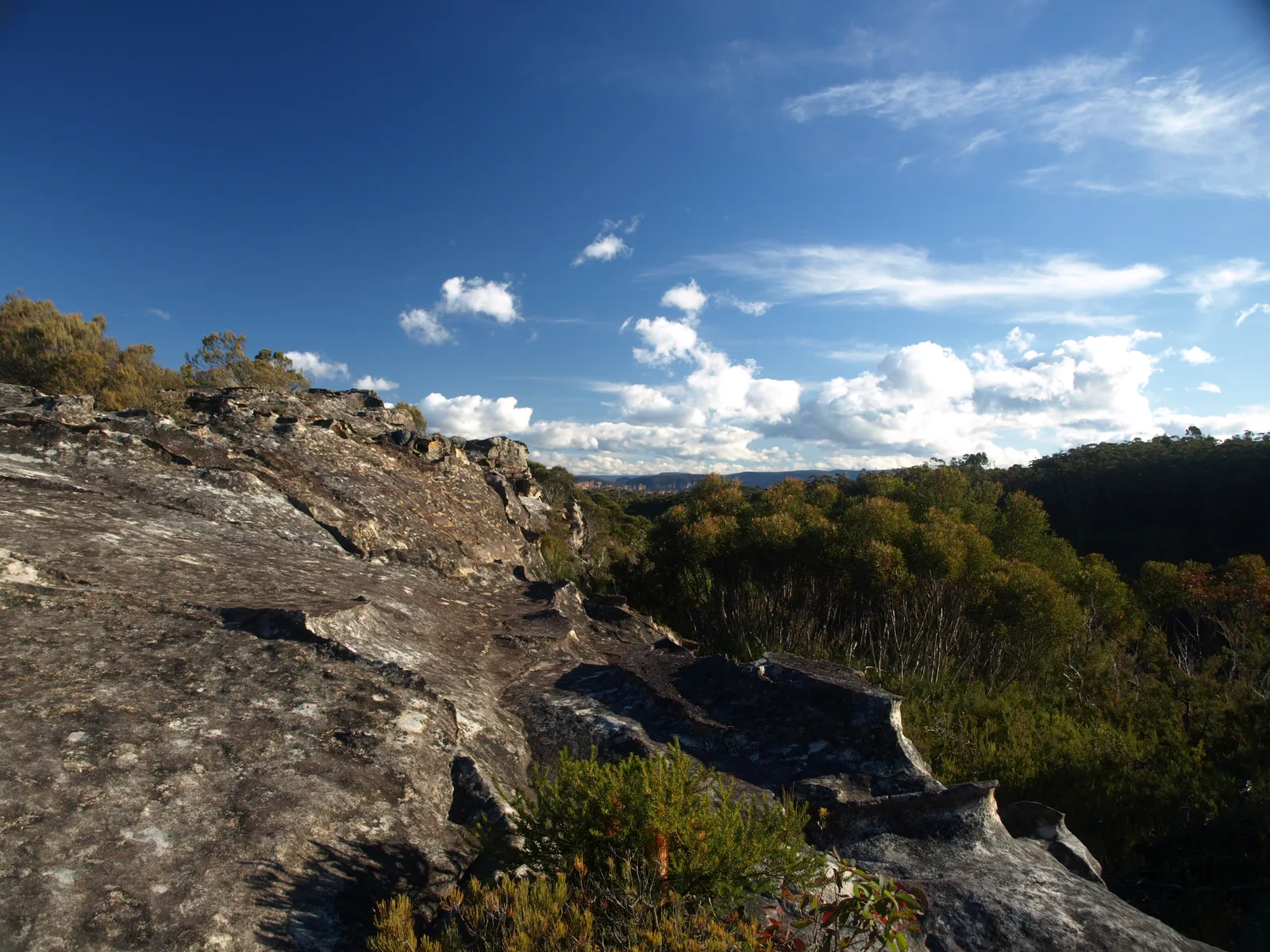
Ingar campground camping on Kings Tableland, inside the Katoomba area of Blue Mountains National Park, is one of the quieter ways to sleep out within a couple of hours of Sydney. It is a small, basic bush camp beside a natural waterhole, set on a plateau above the Wentworth Falls and Woodford end of the mountains. There is one thing to settle before anything else: you cannot drive in. Every camper arrives on foot or by bike, carrying water, food, shelter and firewood.
Can you camp at Ingar Campground?
Yes. NSW National Parks and Wildlife Service (NPWS) lists Ingar as an open campground for tent and remote or backpack camping, with eight sites. The sites are unpowered and unmarked. It does not suit caravans, camper trailers or anyone who wants to pull up beside the tent, because vehicles are not allowed to reach the camp.
NPWS lists a fire ban for the campground from 8 October 2026 to 31 March 2027 (read on 29 October 2026), and says the Katoomba area can close at times for maintenance, poor weather or fire danger. Check the alerts page for the campground before every trip, not only when you book.
Is Ingar campground free?
Partly. NPWS states that there are no camping fees at Ingar, but a booking fee applies when you reserve online. So the answer to searches for free camping in the Blue Mountains is that the site itself is not charged, yet you still need a booking and the booking carries a small fee.
Do you need to book Ingar campground?
Yes, bookings are made online through NPWS. An online booking covers up to 12 people or 2 sites. School groups and Park Eco Pass holders can lodge a group booking enquiry instead. The National Parks Contact Centre on 1300 072 757 (7am to 7pm daily) can help if the online system will not cooperate.
None (booking fee)Camping fee
Required, onlineBooking
Walk or cycle inVehicle access
8, unpoweredSites
How do you get to Ingar campground?
There is no vehicle access to the campground at this time, so the real question is where you leave the car and which trail you walk or ride. NPWS describes two approaches.
- From Woodford: drive south on Bedford Road for 4 kilometres and park at the Bedford Creek trail intersection. From there, walk about 5 kilometres along Bedford Creek trail and Ingar Road. This is the shorter option.
- From Wentworth Falls: drive south on Tableland Road for about 9 kilometres and park at the intersection with Andersons trail. Then walk or cycle 13 kilometres along Andersons trail, Bedford Creek trail and Ingar Road.
NPWS also lists parking at the Bedford Creek turnoff from Murphys Road. Both trails have steep sections and can become inaccessible in wet weather, and creeks can flood after rain. NPWS describes the roads leading to the trailheads as unsealed and suitable for 2WD, with a 4WD required in wet weather. NPWS also describes a 19 kilometre one-way ride or walk rated medium, taking 3 to 4 hours, which starts at Queen Elizabeth Drive about 4 kilometres from Wentworth Falls Station. On that route the campground is reached by a turn of roughly 700 metres off the main trail. That page warns that some navigation may be needed and that Bedford Creek trail is recommended only for experienced, well-prepared and very fit riders, so cyclists should read it before choosing a route.
What is the camp like, and who does it suit?
The campground sits beside a natural waterhole, formed by a dam on Ingar Creek, and NPWS promotes it for swimming, paddling and lilo floating. The facilities are minimal: non-flush toilets, wood barbecues, picnic tables and a carpark. There is no drinking water, no mobile phone reception and no powered sites.
It suits:
- Backpackers and hikers who want a short first overnight walk, especially from the Woodford side.
- Mountain bikers doing the Wentworth Falls to Woodford route as an overnight rather than a day ride.
- Families with older children who can carry their own gear and enjoy a swimming hole.
Choose somewhere else if you need showers, powered sites, vehicle access or a pet.
Does Ingar campground have showers and toilets?
There are non-flush toilets. NPWS does not list showers, and the swimming hole is not a substitute for washing facilities, so plan on a dry camp. Wood barbecues and picnic tables are provided for cooking and eating.
Can you drink the water at Ingar?
No. NPWS says there is no drinking water at the campground. Water from the dam or creek must be treated or boiled before drinking. NPWS also tells campers to bring their own drinking water and cooking water.
Is Ingar campground dog friendly?
No. NPWS says pets and domestic animals are not permitted at the campground, other than certified assistance animals.
What are the rules at Ingar?
- Pets: not permitted, except certified assistance animals.
- Smoking: NSW national parks are no-smoking areas.
- Fires: the campground has wood barbecues and expects you to bring your own firewood, but an NPWS fire ban applies from 8 October 2026 to 31 March 2027, so check before you rely on a wood fire. The NSW Rural Fire Service can declare a total fire ban for particular fire areas or for the whole state in dangerous weather. Check the NPWS alerts page and the Rural Fire Service on the day you leave.
- Generators and rubbish: the campground page does not state rules for either. Carry your rubbish out and ask NPWS if you plan to bring any equipment that makes noise.
When is the best time to camp at Ingar?
NPWS does not nominate a season for the campground itself. For spring, the NPWS route page notes wildflowers across the open heath. For the weather, the best nearby station figures are Katoomba, which sits higher than Wentworth Falls, so treat the table below as a guide rather than a forecast for the camp. The Wikipedia climate table for Katoomba (1991 to 2020 normals) gives these figures.
| Season | Mean minimum | Mean maximum | What it means for camping |
|---|---|---|---|
| Summer (Dec to Feb) | 11.9 to 13.5 C | 22.6 to 24.2 C | Best for the swimming hole; wettest months in the table, with February the highest rainfall |
| Autumn (Mar to May) | 6.3 to 11.7 C | 14.1 to 20.7 C | Cooler, with drier months from April |
| Winter (Jun to Aug) | 2.9 to 4.1 C | 10.6 to 12.2 C | Cold nights, frost is common, record lows below minus 5 C |
| Spring (Sep to Nov) | 5.8 to 10.1 C | 15.6 to 20.6 C | Wildflowers on the heath; cool mornings |
Annual rainfall at Katoomba averages roughly 1,300 millimetres, and the table shows rain on around 150 days a year. Wet weather can make the trails inaccessible, so check conditions before you leave.
Wildlife and safety
NPWS notes eastern water dragons in the daytime, and sugar gliders, possums and bandicoots at night. Keep food sealed.
This is a remote camp, and the safety advice is specific:
- There is no mobile phone reception. Triple Zero (000) needs reception to connect, and NPWS recommends downloading the Emergency Plus app before the trip, which uses your phone’s GPS to help emergency services locate you.
- Fill in the free trip intention form and leave it with an emergency contact.
- Hire a personal locator beacon. NPWS says they are free to hire from the Blue Mountains Heritage Centre in Blackheath (9am to 4pm daily).
What to bring for Ingar
- Drinking water and cooking water for the whole stay, plus a way to treat or boil water from the dam or creek.
- Firewood, if fires are permitted on the day, and a fuel stove as a backup. A total fire ban rules out the wood barbecues.
- A tent you can carry, a sleeping bag suited to cold nights if you are going in the cooler months, and a mat.
- A hat, sunscreen, snacks and clothing for changing weather.
- A map or offline navigation, because NPWS says some navigation may be needed on the route.
- For riders, a helmet and bike repair kit, which NPWS lists among recommended items.
- A rubbish bag to carry everything out.
What is there to do nearby?
The swimming hole is the main draw at the camp. Beyond it, the Wentworth Falls to Woodford route is shared by walkers and mountain bikers, and NPWS asks riders to give way to walkers. The surrounding Kings Tableland is a heath and open forest plateau, and NPWS describes a rainforest descent towards Bedford Creek.
Wentworth Falls itself has lookouts including Lincoln’s Rock and Princes Rock, the Charles Darwin Walk, Conservation Hut, which is an information centre and restaurant on an NPWS lease, and Wentworth Falls Lake. Kings Tableland also holds Aboriginal sites that Wikipedia says have been used for at least 22,000 years.
Supplies and services
The campground has none of its own, so stock up before you reach the trailhead. Wentworth Falls has a railway station, a library and the Conservation Hut restaurant, and it lies about 8 kilometres east of Katoomba on the Great Western Highway, about 100 kilometres west of the Sydney CBD. Woodford has a railway station on the route. For other shops and fuel, check current opening hours in Katoomba, Wentworth Falls and Woodford.
A one-night plan
- Book online and check the alerts page for fire bans and closures.
- Fill in the trip intention form and collect a locator beacon if you want one.
- Drive to the Bedford Road trailhead near Woodford, park at the Bedford Creek trail intersection, and walk the 5 kilometres to the camp.
- Set up, swim and cook on the wood barbecue only if fires are allowed.
- Walk or ride out the next morning and take everything with you.
A weekend plan
Arrive from Wentworth Falls on the Andersons trail if you want the longer approach, camp two nights, then spend the middle day on the Wentworth Falls to Woodford trail as a day trip from camp.
Alternatives if Ingar does not fit
- Murphys Glen campground: in the Glenbrook area of the same park, it has five unpowered, marked sites for tents and camper trailers. NPWS says 2WD vehicles can generally reach it without a trailer, but a 4WD is needed if towing. It has toilets and barbecue facilities, and there are no camping fees, though a booking fee applies. The access road has a steep gravel exit.
- Euroka campground: also in the Glenbrook area, this has five camping areas for tents, with toilets, barbecues and picnic tables. Camping fees are charged and park entry is separate, and park gates have set opening hours.
Planning checklist
- Booking made and confirmed.
- Fire ban and trail closure alerts checked on the day.
- Trailhead and walking distance chosen.
- Water, treatment gear and food packed.
- Trip intention form filed and beacon arranged.
- Offline map downloaded.
- Wet-weather plan ready.
Common mistakes
- Expecting to drive in. Vehicle access is not available, so plan for a walk or ride.
- Bringing the dog.
- Relying on the dam water without treating it.
- Assuming a wood fire is allowed. Fire bans change quickly.
- Trusting mobile reception. There is none at the camp.
- Taking Bedford Creek trail on a bike without the fitness for its steep descent and climb.
- Forgetting that the booking fee applies even though camping itself carries no fee.
More from the operator: nationalparks.nsw.gov.au/camping-and-accommodation/campgrounds/ingar-campground.
Plan it in the app
Save the camp on your route in MotoRidez and the planner shows road closures along the way, and where your tank runs out once you have entered the range of your vehicle. Save the route for offline use before you lose signal: it saves the corridor around your route, not a whole region.
Details come from the operator’s own records and pages, read on 20 October 2026, and change. We do not show prices or availability. Confirm fees, bookings, closures and fire rules with the operator before you go.
Questions riders ask
Can you camp at Ingar Campground?
Yes. NPWS lists it as an open campground with eight unpowered, unmarked sites for tent and backpack camping. Check the alerts page first, as a fire bans alert applies at the time of writing.
Is Ingar Campground free?
NPWS says there are no camping fees, but a booking fee applies when you book online. Check the NPWS campground page for current details.
Do you need to book Ingar Campground?
Yes, book online with NPWS. An online booking covers up to 12 people or 2 sites, and the Contact Centre is on 1300 072 757.
Can you drive to Ingar Campground?
No. There is no vehicle access, so you walk or cycle in, about 5 km from the Bedford Creek trail near Woodford or 13 km along Andersons trail from Wentworth Falls.
Does Ingar Campground have showers and toilets?
It has non-flush toilets. NPWS does not list showers, and there is no drinking water, so bring your own.
Is Ingar Campground dog friendly?
No. Pets and domestic animals are not permitted, other than certified assistance animals.
When is the best time to camp at Ingar?
NPWS does not name a season. Summer suits the swimming hole, spring brings heath wildflowers, and winter nights are cold with common frost at nearby Katoomba.
Free, no subscription
Plan the curvy bits. Record the ride.
Watch your
map fill in.
Curvy routing, turn-by-turn voice navigation, ride recording and your ridden-roads map, with nothing behind a paywall.



Join the waitlist
Bring MotoRidez to your roads
The more riders register from your region, the sooner we get there. Put your name down, then send it to your ride group to move your region up the queue.
You're on the list ✓
Nice — you're in the queue
Every rider you bring moves your region up the list. Share it with your mates and your ride groups.