
Route 66 Motorcycle Itinerary: 14 Days, Chicago to Santa Monica
A Route 66 motorcycle itinerary from Chicago to Santa Monica: 10, 14 and 21 day plans, the empty stretches, the broken sections and the best months.
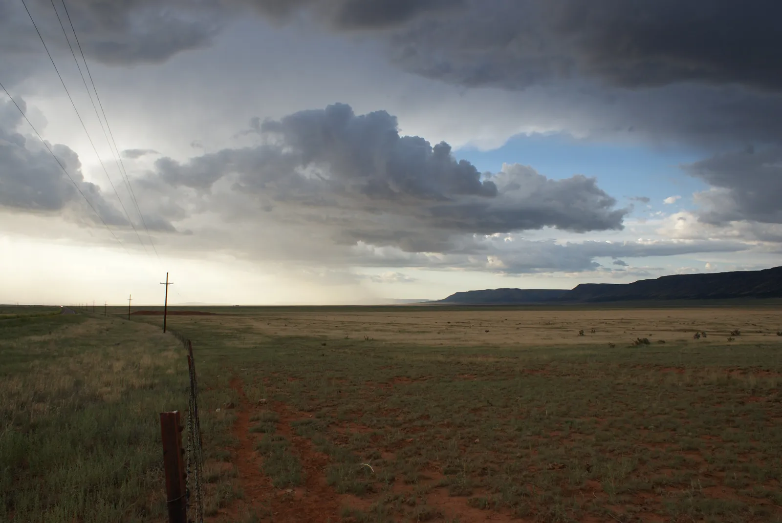
Route 66 is the most famous road in America, and officially it has not existed since 1985. It was removed from the US highway system on 26 June 1985, so the Chicago to Santa Monica road trip you are planning is a trail you assemble yourself, from preserved stretches, frontage roads and the odd gap you take on the interstate. That is not a flaw. It is the reason a motorcycle suits it: you get to choose the good bits.
This is a Route 66 motorcycle itinerary built around that fact: how many days to plan, where the road is sparse, which sections have broken, and which months to ride. The road runs about 2,448 miles (3,940 km), through eight states.
How many days do you need for Route 66 on a motorcycle?
Plan for 14 days. Planning guides put a full trip at 10 to 16 days, and most settle on two weeks: about 175 miles (280 km) a day, with room for the stops that make the trip.
- 10 days: about 245 miles (395 km) a day. Possible, but you will ride past most of what you came for and lean on the interstate in the Southwest.
- 14 days: the recommendation. One day in each of Missouri and Texas, two in Illinois, Oklahoma and California, three in Arizona, two in New Mexico, and one flex day for weather.
- 21 days: about 117 miles (188 km) a day. Room for a Grand Canyon day, a rest day in Albuquerque or Flagstaff, and the side loops you would otherwise skip.
Which way, and when does the trip start?
Most travellers ride east to west, which follows the road’s original direction of travel. It starts at Michigan Avenue and Jackson Boulevard, near the Art Institute of Chicago. The official western end is at Lincoln and Olympic Boulevards, but the Santa Monica pier is the symbolic finish.
- IllinoisChicago to St Louis301 miles
- Missouri, KansasSt Louis to Joplin305 miles
- OklahomaQuapaw to Texola375 miles
- TexasThe Panhandle179 miles
- New MexicoGlenrio to Gallup380 miles
- ArizonaPetrified Forest to Topock401 miles
- CaliforniaNeedles to Santa Monica315 miles
Illinois: Chicago to Springfield and St Louis (about 301 miles, 484 km)
Illinois was the first of the eight states to finish its segment, and in WWII it carried heavy military traffic that damaged the road and earned it the nickname Bloody 66. Today much of it has been replaced by Interstate 55, with the old road surviving as frontage roads and local streets.
The stop worth making: the Ariston Café in Litchfield.
Overnight: Springfield, the state capital, which the original road passed through.
Plan for: a gentle opening. Frontage roads and local streets mean slow average speeds, so do not judge the day by the mileage.
Missouri and Kansas: St Louis to Joplin (about 292 miles, 470 km, plus 13 in Kansas)
The Chain of Rocks Bridge carried the St Louis bypass across the Mississippi. After it, the road rolls through the Ozarks: Stanton and the Meramec Caverns, Rolla, where a half-scale Stonehenge sits beside the highway at a curve, Lebanon, Springfield and Carthage.
The stop worth making: Springfield, for Red’s Giant Hamburg, described as the world’s first drive-thru restaurant. Carthage is the better overnight pick if you want a smaller town: its 66 Drive-In dates from 1949 and is listed on the National Register of Historic Places.
Broken sections: the 1931 Meramec River bridge at Times Beach was bypassed in 1956 and is no longer passable, and the historic Gasconade River bridge has been closed by the state. Expect detours around both and check current conditions.
Kansas gets only about 13 miles (21 km), through Galena, Riverton and Baxter Springs, but it was the first state to pave its stretch, in 1929. The Rainbow Bridge over Brush Creek is on the National Register.
Oklahoma: Quapaw to Texola (about 375 miles, 603 km)
Oklahoma’s Route 66 comes in pieces. Northeast of Oklahoma City, Interstate 44 is mostly a toll road and State Highway 66 remains as the free alternative. West of the city, Interstate 40 replaced most of the road, and what survives sits on business loops through Sayre, Elk City, Clinton and El Reno.
The stop worth making: Arcadia, where Pops marks the road with a 66-foot (20 m) neon soda bottle and the Round Barn has served as a community hall since 1898.
Don’t miss: the Miami stretch, about 9 feet (2.7 m) wide, known as the sidewalk highway and listed on the National Register.
Tulsa: the road entered on the 1916 concrete 11th Street Bridge and passes 29 historical markers over roughly 26 miles (42 km) through the city. Clinton has the Oklahoma Route 66 Museum, and Elk City the National Route 66 Museum. Spring is tornado season here: see the weather section.
For the roads rather than the history, see Oklahoma’s best motorcycle roads.
Texas: the Panhandle (about 179 miles, 288 km)
Texas shows you what the interstate did. I-40 bypassed Glenrio, Adrian, Vega, Groom, Alanreed, McLean and Shamrock, and outside the towns Route 66 is mostly a frontage road.
The stop worth making: Amarillo, the only major city on the Texas stretch, with the Cadillac Ranch and the 6th Street Historic District. Adrian bills itself as the midpoint of Route 66. Groom has a large cross and a leaning water tower, Shamrock the restored U-Drop Inn, and Vega a motel that opened in 1947.
Glenrio, on the New Mexico line, became a ghost town after the road was bypassed in 1973.
Plan for: a short riding day with long stops.
New Mexico: Glenrio to Gallup (about 380 miles, 610 km)
New Mexico has two Route 66s. Until 1937 the road swung north through Santa Fe. A direct cutoff from Santa Rosa to Albuquerque first opened in 1927, and in 1937 US 66 was officially moved onto the shorter route. Parts of the older Santa Fe road survive, and some are barely drivable.
The stop worth making: Tucumcari, which grew a motel boom and the roadside slogan “Tucumcari tonite!”. The Blue Swallow Motel there is on the National Register of Historic Places.
Broken sections: the original alignment from San Jon through Bard and Endee to Glenrio is now gravel. Several old pieces near Santa Fe and Las Vegas are barely drivable.
Albuquerque: the later alignment runs east to west as Central Avenue, and the city now maintains the old road. West of the city the road crosses mountainous terrain and passes Laguna Pueblo on the way to Gallup. New Mexico’s best roads are worth a side trip if you have the days.
Arizona: Petrified Forest to Topock (about 401 miles, 645 km)
This is the section people ride Route 66 for, and the one that needs the most care.
Petrified Forest and the Painted Desert: the old road runs through an abandoned roadbed in the Painted Desert before merging into I-40 near Lupton.
Winslow to Flagstaff: Meteor Crater’s access road is just off the old alignment, and Canyon Diablo Bridge leads to the abandoned Two Guns tourist site. Flagstaff sits at about 7,000 feet (2,100 m), so mornings are cold even in summer.
Broken sections: between Ash Fork and Williams the old road is partly abandoned. West of Flagstaff, Mountain Man Trail and Deer Farm Road are graded dirt. If you are not on an adventure bike, take the interstate.
Seligman to Topock: riders describe about 120 miles (193 km) of original alignment from the Crookton Road turn-off to Topock, with Peach Springs, the Grand Canyon Caverns and Hackberry along it. This is the longest satisfying piece of old road and the best place for the extra day.
Oatman: the road over the Black Mountains was bypassed in 1953. It climbs through the Gold Hill Grade to Sitgreaves Pass, at about 3,550 feet (1,080 m), then drops steeply to Oatman. Riders note no guardrails, loose sand and gravel, tar repairs, and wild burros in town. Cross it in daylight.
Fuel: top up in the larger towns, and check what is open on the day. Small-town stations can keep short hours.
California: Needles to Santa Monica (about 315 miles, 507 km)
The Colorado River crossing at Topock needs I-40: the 1916 steel arch bridge now carries a pipeline. Then comes the stretch that decides how you pack.
The empty stretch: the milepost table puts Needles at about 294 miles from Santa Monica and Barstow at 152, so roughly 142 miles (229 km) of mostly desert between them. Riders describe few services between Mountain Springs Summit and Ludlow. Amboy has a café and gas, but check that it is open. The Mojave National Preserve advises at least one gallon of water per person per day, and notes that cell coverage there is sporadic.
The stop worth making: Amboy, then the 28 miles (45 km) of old road on to Ludlow.
Broken sections: east of Barstow, a Marine Corps base limits public access and pushes traffic onto I-40. A section in San Bernardino County was reported closed for bridge repairs in December 2024. Check current conditions with Caltrans.
Cajon Pass: the original road climbs it from San Bernardino. The Summit Inn, which opened in 1928, was destroyed by the Blue Cut Fire in 2016.
Santa Monica: the road was extended here in 1935.
What is the weather like on Route 66, and when should you ride it?
Climate figures are from Open-Meteo historical data (ERA5 reanalysis), 2015 to 2024 averages.
| M | A | M | J | J | A | S | O | |
|---|---|---|---|---|---|---|---|---|
| Best months | Best months | |||||||
| Storms, monsoon, heat | Storms, monsoon, heat | |||||||
| Chicago | 45°37% | 54°46% | 65°41% | 77°40% | 80°39% | 80°39% | 74°32% | 62°38% |
| Tulsa | 64°31% | 70°36% | 78°49% | 89°29% | 92°31% | 90°33% | 85°23% | 73°28% |
| Albuquerque | 63°17% | 72°8% | 80°11% | 91°9% | 93°14% | 90°11% | 85°12% | 71°12% |
| Flagstaff | 50°25% | 61°13% | 68°20% | 82°11% | 84°38% | 81°36% | 75°21% | 64°18% |
| Los Angeles | 70°26% | 76°8% | 76°9% | 83°2% | 88°2% | 90°3% | 88°4% | 83°7% |
- under 50°
- 50 to 59°
- 59 to 68°
- 68 to 77°
- 77 to 86°
- 86° and over
See the figures as a table
| Month | Chicago | Tulsa | Albuquerque | Flagstaff | Los Angeles |
|---|---|---|---|---|---|
| Mar | 45/31°F, 37% | 64/43°F, 31% | 63/37°F, 17% | 50/29°F, 25% | 70/49°F, 26% |
| Apr | 54/39°F, 46% | 70/51°F, 36% | 72/44°F, 8% | 61/36°F, 13% | 76/52°F, 8% |
| May | 65/50°F, 41% | 78/60°F, 49% | 80/53°F, 11% | 68/43°F, 20% | 76/55°F, 9% |
| Jun | 77/61°F, 40% | 89/70°F, 29% | 91/64°F, 9% | 82/56°F, 11% | 83/60°F, 2% |
| Jul | 80/66°F, 39% | 92/74°F, 31% | 93/69°F, 14% | 84/60°F, 38% | 88/64°F, 2% |
| Aug | 80/66°F, 39% | 90/73°F, 33% | 90/67°F, 11% | 81/58°F, 36% | 90/65°F, 3% |
| Sep | 74/61°F, 32% | 85/67°F, 23% | 85/60°F, 12% | 75/53°F, 21% | 88/64°F, 4% |
| Oct | 62/48°F, 38% | 73/55°F, 28% | 71/48°F, 12% | 64/43°F, 18% | 83/59°F, 7% |
These are city figures. The Mojave between Needles and Barstow and the Arizona lowlands are not in the data and run hotter than Albuquerque.
Spring storms in the plains. The Storm Prediction Center says the peak tornado period in the southern Plains is May into early June, and June or July in the northern Plains and upper Midwest. A May start puts you in Oklahoma at the worst time. Check forecasts daily, and move on early if a system is forecast.
Monsoon in the Southwest. Flagstaff’s summer monsoon runs July to September, with July and August the wettest months. It brings flash floods in dry washes, lightning and dust storms. The National Weather Service advice for a dust storm on the road is to pull as far off the pavement as you can, turn the lights off and wait. On a bike, don’t stop in the travel lane.
Heat. June to August is hot in Albuquerque and hotter in the lowland desert. Start at first light, stop in the middle of the day and drink often.
Snow. Flagstaff averages roughly 90 to 97 inches (230 to 250 cm) of snow a year, and I-40 has closed there during storms. Don’t plan to cross northern Arizona between November and March, and treat April as a risk.
The best months. September to mid October: the monsoon is ending, spring storm season is behind you, and highs across the route stay mild. May and June are the other popular choice, but you trade Oklahoma storm risk or Albuquerque heat for it.
Where to stop for the night
Planning anchors: Springfield, Illinois; Carthage or Springfield, Missouri; Tulsa or Clinton, Oklahoma; Amarillo, Texas; Tucumcari and Albuquerque, New Mexico; Gallup; Holbrook or Winslow, then Flagstaff, Arizona; Seligman or Kingman; and Barstow, California.
Plan it in MotoRidez
MotoRidez is free, with no subscription, on iPhone and Android. Build the trip as a curvy route, so you get the best roads between the Route 66 towns and not just the straightest line. Download offline maps before the Mojave, where cell coverage is thin. Read how to plan fuel range and how offline maps work for road trips before you go, and Arizona’s best roads if you want extra days around Flagstaff.
Questions riders ask
How long does it take to ride Route 66 on a motorcycle?
Planning guides put a full Chicago to Santa Monica trip at 10 to 16 days, with 14 as the best balance of riding and stopping. On a bike that works out at about 175 miles (280 km) a day. Ten days means roughly 245 miles (395 km) a day, which leaves little time to see anything.
Can you do Route 66 in two weeks?
Yes, and two weeks is the most common recommendation. It gives you about 175 miles (280 km) a day, so you can follow the historic road for the best sections and take the interstate when a day needs to be short on fuss. Add a day or two if you want to stop at Oatman and Petrified Forest without hurrying.
Which direction should you ride Route 66?
Most travellers go east to west, from Chicago to Santa Monica, which follows the road's original direction of travel. Either direction works. Your timing matters more: start early in the desert in any direction, and pick the month first.
How long is Route 66 in miles?
About 2,448 miles (3,940 km) from Chicago to Santa Monica. State-by-state figures vary by alignment, because the road was rerouted over the years. Roughly: Illinois 301 miles, Missouri 292, Kansas 13, Oklahoma 376, Texas 178, New Mexico 380, Arizona 401 and California 315.
Is Route 66 still a continuous road?
No. It was removed from the US highway system in 1985 and today is a patchwork of preserved stretches, frontage roads, business loops and some gravel or closed sections. You need a route that stitches them together, and a fallback to the interstate for the gaps.
What is the best time of year to ride Route 66?
Late spring and early autumn are the usual advice, because summer is very hot in the desert. For a bike, September to mid October is the best fit: past the summer monsoon, past spring storm season, and still warm at both ends. Winter brings snow to Flagstaff, which sits at about 7,000 feet.
Is the Oatman road dangerous on a motorcycle?
It is demanding rather than impossible. Riders describe tight curves, steep drops and no guardrails on the Gold Hill Grade, plus wild burros in Oatman that have the right of way. Ride it in daylight, slow, and watch the surface for sand, gravel and tar repairs.
Free, no subscription
Plan the curvy bits. Record the ride.
Watch your
map fill in.
Curvy routing, turn-by-turn voice navigation, ride recording and your ridden-roads map, with nothing behind a paywall.



Join the waitlist
Bring MotoRidez to your roads
The more riders register from your region, the sooner we get there. Put your name down, then send it to your ride group to move your region up the queue.
You're on the list ✓
Nice — you're in the queue
Every rider you bring moves your region up the list. Share it with your mates and your ride groups.